
Mountain type Orthogneiss Elevation 2,703 m Prominence 667 m | Topo map USGS Eldorado Peak Easiest route East Ridge, class 2 First ascent 27 August 1933 | |
 | ||
First ascenders Norval Grigg, Donald Blair, Arthur Winder, Arthur Wilson Similar Forbidden Peak, Goode Mountain, Buckner Mountain, Boston Peak, Sahale Mountain | ||
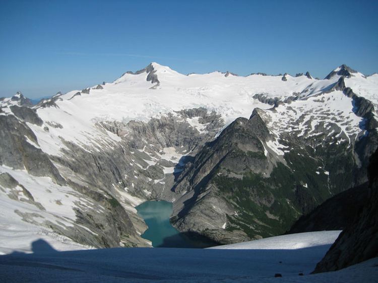
Eldorado Peak is a 8,868-foot (2,703 m) peak, and is the 25th highest peak in Washington. The mountain is located in the North Cascades of Washington, approximately 27 miles (43 km) east of Concrete. It is located in North Cascades National Park at the head of Marble Creek and just west of the Inspiration Glacier. Other glaciers in the immediate vicinity include Eldorado Glacier and McAllister Glacier; thus Eldorado is flanked by the largest continuous non-volcanic ice sheet in the lower 48 states.
Contents
Map of Eldorado Peak, Washington, USA
Orography
Eldorado appears quite different depending on the side one is viewing. On the west side the peak is a steep face made of vertical slabs and small gullies. From the east side the mountain is a small rocky outcropping surrounded by ice. The south face is a triangular face flanked by long ridgelines. The most popular and easiest climbing route is from the south and east, via the Inspiration Glacier and a moderately steep snow ridge. Eldorado is a popular climbing destination due to easy access, being one of the 100 highest peaks in Washington, and superb mountain views. Most climbers will take two days to complete the trip, though the climb can be completed in one long day.
Routes
Geology
Eldorado is very simple geologically when compared to other mountains in the Cascades, with only one major rock type, Cretaceous orthogneiss, more specifically biotite granodiorite . Only the lowest flanks are made of different rock types, mostly heterogeneous metamorphic rock. There are only two normal faults: one on the east flank, the other on the west flank.