
Last eruption 934 | ||
 | ||
Similar Laki, Askja, Kerlingarfjöll, Katla, Hekla | ||
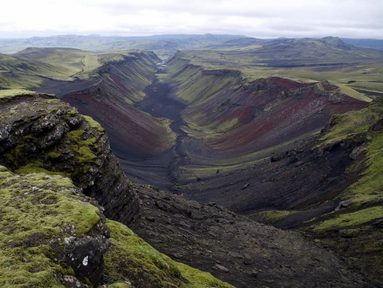
Eldgjá ([ˈɛltcau], "fire canyon") is a volcano and a canyon in Iceland. Eldgjá and the Katla volcano are part of the same volcanic system in the south of the country.
Map of Eldgj%C3%A1, Iceland
Situated between Landmannalaugar and Kirkjubæjarklaustur, Eldgjá is the largest volcanic canyon in the world, approx. 40 km long, 270 m deep and 600 m wide at its greatest. It was discovered by Þorvaldur Thoroddsen in 1893. The first documented eruption in 934 (or 939) was the largest flood basalt in historic time. The areal extent of the lava is around 800 km2. An estimated 18 km3 of magma poured out of the earth.
There is a waterfall named Ófærufoss within the canyon. A natural bridge across the waterfall vanished in 1993 due to excess water from melting ice.
The northern part of Eldgjá, including Ófærufoss, and surrounding areas, have been a part of Vatnajökull National Park since 2011.