
[County] Jose Sixto Verduzco Time zone CST (UTC-6) Area 10.5 km² Population 1,596 (2010) Area code 438 | Incorporated November, 1920 FIPS code MX16 Elevation 1,690 m Zip code 58541 | |
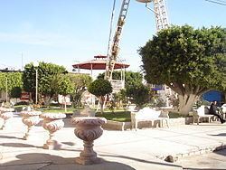 | ||
El Rodeo de San Antonio
Contents
Map of El Rodeo de San Antonio, Michoac%C3%A1n, Mexico
El Rodeo de San Antonio is located in the state of Michoacán, Mexico. This community belongs to the municipal of Jose Sixto Verduzco and is located between the borders of the state of Michoacán and Guanajuato. El Rodeo is formally known as Heroes de Chapultepec but it is popularly known as El Rodeo de San Antonio. The town is home to more than 2000 residents. However, another 4500 people currently have immigrated to the United States.
Population
This town has more than 1500 permanent residents and 3000 temporary residents. The inflow and outflow of people stays around 1000 per year to and from the United States.
Immigration
About 50% of all the population has immigrated to the United States. From the percentages that immigrates, 20% currently reside in California and the other 80% resides in other parts of the United States. The percentage always varies but the mean always stays within the same range.