
Website Manfut-ElRama | Climate Am Area 5,618 km² | |
 | ||
Department | ||
Singing karaoke at el vivero eco hostel in el rama nicaragua
El Rama is a municipality in the South Caribbean Coast Autonomous Region of Nicaragua.
Contents
- Singing karaoke at el vivero eco hostel in el rama nicaragua
- Map of Rama Nicaragua
- Bamb social el rama nicaragua
- History
- Settlements
- Twin cities
- References
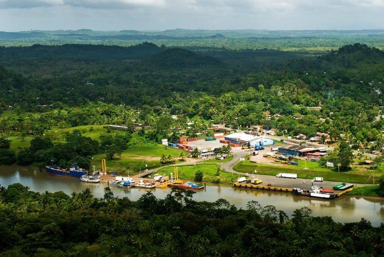
Map of Rama, Nicaragua
It is along the Escondido River which branches off into three other rivers: the Sumi, Rama, and Escondido. It is home to an important Atlantic/Caribbean port. Its population is approximately 50,000 people.
Bamb social el rama nicaragua
History
Rama is an old settlement, whose name is reminiscent of their first settlers, the Caribbean indigenous Rama, once populate the territories of the present municipalities of Bluefields and Rama. Unlike the Miskito, this ethnic group did not subordinated to the British and other European nations from 1633. Ethnicity also fought pirates and Spanish conquistadors who sought to enslave during the conquest.
The municipality increased its importance in the late nineteenth century, with the beginning of the extraction of timber, rubber and banana enclave by US companies. This economic activation caused a strong flow from other parts of the country as well as citizens of Chinese origin, who were primarily devoted to trade. The construction of the Managua-Rama highway facilitated successive waves of migration of peasants
Settlements
There are a total of 98 communities: among which we can to mention: