
Location Mexico | Established October 13, 2000 | |
 | ||
Location Texas and New Mexico, United States Nearest city El Paso, TX, Las Cruces, NM, Albuquerque, NM, Santa Fe, NM Visitors Not available (in 2005) Governing body National Park Service, Bureau of Land Management Website El Camino Real de Tierra Adentro National Historic Trail Management National Park Service, Bureau of Land Management Nearest cities El Paso, Las Cruces, Albuquerque, Santa Fe | ||
Take a journey along el camino real de tierra adentro national historic trail
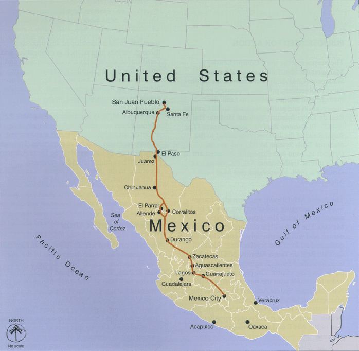
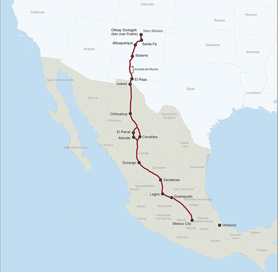
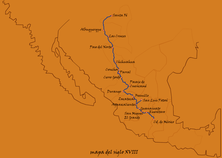
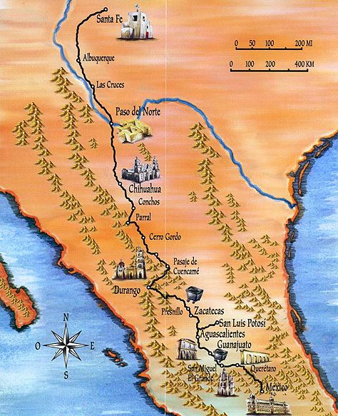
El Camino Real de Tierra Adentro National Historic Trail (Spanish for "The Royal Road of the Interior Land") was a 1,600 mile (2560 kilometer) long trade route between Mexico City and San Juan Pueblo, New Mexico, from 1598 to 1882.
Contents
- Take a journey along el camino real de tierra adentro national historic trail
- New mexico pbs moments in time the last hurdle el camino real de tierra adentro
- History
- Present day access
- CARTA
- References
The 404 mile (646 kilometer) section of the route within the United States was proclaimed as a part of the United States National Historic Trail system on October 13, 2000. The trail is overseen by both the National Park Service and the U.S. Bureau of Land Management with aid from El Camino Real de Tierra Adentro Trail Assoc. also known as CARTA.
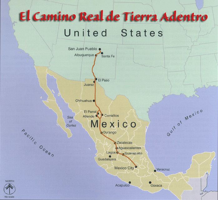
Various sites and cities along the Mexican section of the trail were declared a World Heritage Site by the UNESCO in 2010. Those sites include Ojuelos de Jalisco, the place where the first fortification was built in 1569 and Zacatecas, the city in which a rich silver mineral mine triggered the original construction of the "El Camino Real de Tierra Adentro".
A portion of the trail near San Acacia, New Mexico was listed on the National Register of Historic Places in 2014.
New mexico pbs moments in time the last hurdle el camino real de tierra adentro
History
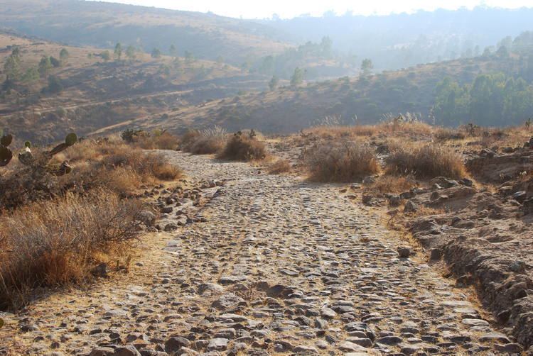
The trail was used for trade among native tribes since the earliest of times. In 1598, Oñate followed the trail while leading a group of settlers North during the era of Spanish conquest. The duration of the trip from the Rio Grande to the San Juan Pueblo was said to take, by wagon and by foot, approximately 6 months including 2–3 weeks of rest throughout the trip. According to journals kept by settlers they used common animals found along the trail to add to the food they brought along. The trail greatly improved trade among Spanish villages and helped the Spanish conquistadors spread Christianity throughout the conquered lands. The trail was used from 1598 through 1881 when the railroad replaced the need for wagons. Eventually, railroads replaced rutted trails and over time the trail and evidence of it faded from sight and memory. The changes that the railways brought made trade along El Camino much easier and in some cases made travel quite luxurious and exciting.
Present day access
From the Texas-New Mexico border to San Juan Pueblo north of Española, a drivable route, mostly part of former U.S. Route 85, has been designated as a National Scenic Byway called El Camino Real.
Portions of the trade route corridor also contain pedestrian, bicycle, and equestrian trails. These include the existing Paseo del Bosque Trail in Albuquerque and portions of the proposed Rio Grande Trail. Its northern terminus, Santa Fe, is a terminus also of the Old Spanish Trail and the Santa Fe Trail.
Along the trail, parajes (stop overs) that have been preserved today include El Rancho de las Golondrinas.
Fort Craig and Fort Selden are also located along the trail.
CARTA
El Camino Real de Tierra Adentro Trail Association (CARTA) is a non-profit trail organization that aims to help promote, educate, and preserve the cultural and historic trail in collaboration with the National Park Service, the Bureau of Land Management, the New Mexico Department of Cultural Affairs and various Mexican organizations. CARTA publishes an informative journal, Chronicles of the Trail, quarterly that provides people with further history and current affairs of the trail and what CARTA, as an organization, is doing to help the trail.