
Altitude 2,570 m (8,432 ft) Material Sandstone | Part of Pre-Muisca sites | |
 | ||
Type Rock shelter, petroglyphs Archaeologists Gonzalo Correal Urrego, Thomas van der Hammen | ||
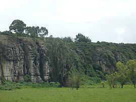
El Abra is an archaeological excavation site, located in the valley of the same name, east of the city of Zipaquirá, department Cundinamarca, Colombia; on the Altiplano Cundiboyacense, at an altitude of 2,570 metres (8,430 ft). This cave system is one of the first evidences of human settlement in the Americas, dated at 12,400 ± 160 years BP, used by the hunter-gatherers of the late Pleistocene epoch. The rock shelter, containing petroglyphs, is situated at the northern edge of the Bogotá savanna.
Contents
- Map of El Abra ZipaquirC3A1 Cundinamarca Colombia
- Stratigraphy
- Archaeological research
- Fquene stadial
- Guantiv interstadial
- Tibit stadial
- El Abra stadial
- Holocene
- Aguazuque
- References
Map of El Abra, Zipaquir%C3%A1, Cundinamarca, Colombia
Stratigraphy
The first research in the place was conducted in 1967, and the stratigraphy of lithic instruments, bones and vegetal charcoal with radiocarbon dating established the date of the settlement in 12,400 ± 160 years BP.
Archaeological research
In 1960, the Indiana University collaborated in a deeper research. In 1970 the Dutch Foundation for the Advancement of Tropical Research (NWO-WOTRO) discovered four new preceramic sites and the analysis of lacustrine sediments allowed a more accurate understanding of the paleoclimate and flora.
Fúquene stadial
The Fúquene stadial, named after Lake Fúquene, close to the village of the same name, is defined from 15,000 to 12,500 BP. It is characterized by a cold climate, flora typical of páramo ecosystems, and lithic tools.
Guantivá interstadial
About 12,500 years ago, a gradual rise of temperature allowed the return of Andean cloud forest and the settlement of many animal species, making hunting easier. Articles of this period are abrienses: flint (tool)s, and chopper cores. While the climate was more benign, the cave system was gradually abandoned.
Tibitó stadial
The excavations of this period, near Tocancipá at Tibitó, dated 11,400 years BCE, show lithic instruments, bone tools and remains of Pleistocene megafauna, such as mastodons (Haplomastodon and Cuvieronius hyodon), American horse (Equus amerhipuus lasallei), and deer (Odocoileus virginianus) with traces of ritual ceremonies.
El Abra stadial
Dated 11,000 BP, it is characterized by a new cooling of the climate, recession of the forests and a last glaciation. From this period the archaeological places of Tequendama Falls in Soacha shows lithic instruments (Tequendamenses tools) with a more smooth manufacture, many of them made with materials brought to this place from the Magdalena River valley, such as quartzite.
Holocene
Around 10,000 years BP the last glaciation ended, the Andean forest appeared again. The lithic instruments show a rise in recollecting activities, with rodents and vegetables consumed, and low amounts of large animals hunted. The El Abra caves were abandoned gradually.
Aguazuque
In Aguazuque, around 5,000 BP, agriculture was established on elevated terraces, grinding stone instruments can be observed in association with itinerant habits. The abriense type instruments disappear.