
Elevation 82 m (269 ft) Altitude 67.7 m (222 ft) Maximum gradient 10 % | Location Flanders
Belgium Average gradient 5.8 % Starts Etikhove, Maarkedal | |
 | ||
Length 1,252.81 m (4,110.3 ft) | ||
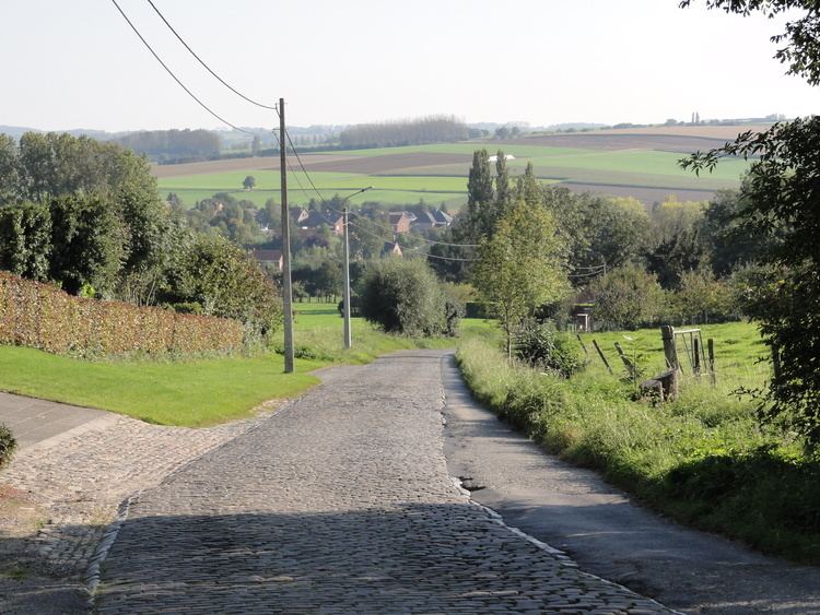
The Eikenberg (English: Oak Hill) is a hill and road in the municipality of Maarkedal, in the Belgian province of East Flanders. With a 82 m altitude top, its is one of many hill formations in the Flemish Ardennes, in the south of East-Flanders.
Contents
Map of Eikenberg, 9680 Maarkedal, Belgium
The slopes of the hill are paved in cobbles, with a road gradually winding upwards from the Maarke brook to the top in Kerzelare village, 3 km east of Oudenaarde. The top of the climb is on the intercity road between Brakel and Oudenaarde. The cobbled climb is one of the regular sites in Flemish cycling races in springtime. In 1995 the road of the Eikenberg was classified as a protected monument.
Cycling
The site is best known from cycling, as it is a regular climb in the Tour of Flanders. The Taaienberg was first included in the course in 1956, and has since often been included, although occasionally it is not run. It is a fairly long climb at 1200 meter, relatively shallow at 5.8% average, but its cobbled surface is the main difficulty of the climb.
In total the Eikenberg has been included in the Tour of Flanders route 40 times (1956-2015). In 2014 and 2015 it was the third climb of the day, situated between the Kortekeer and Wolvenberg.
Eikenberg is also a fixed location in Omloop Het Volk and is sometimes included in E3 Harelbeke, Dwars door Vlaanderen and Three Days of De Panne.