
Website www.egilsstadir.is Local time Tuesday 8:27 PM Number of airports 1 | Constituency Northeast Constituency Time zone GMT (UTC+0) Population 2,306 (2016) Municipality Fljótsdalshérað | |
 | ||
Weather 4°C, Wind SW at 16 km/h, 71% Humidity | ||
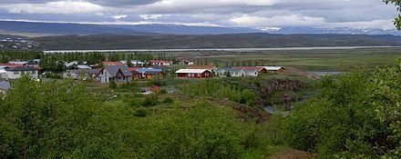
Egilsstaðir is a town in east Iceland on the banks of the Lagarfljót river.
Contents
Map of Egilssta%C3%B0ir, Iceland
It is part of the municipality of Fljótsdalshérað, the county seat of Norður-Múlasýsla and the largest settlement of the Eastern Region with, as of 2016, a population of 2,306 inhabitants.
Overview
Egilsstadir is located at 65°17′N 14°23′W. The town is young, even by Icelandic standards where urbanization is a fairly recent trend compared to mainland Europe. It was established in 1947 as an effort by the surrounding rural districts recognizing it had become a regional service centre. The town, which is named after Egilsstaðir farm, is near the bridge over Lagarfljót where all the main roads of the region meet, Route 1 as well as the main routes to the Eastern Region.
Egilsstaðir has grown to become the largest town of East Iceland and its main service, transportation, and administration centre. The town has an airport, college, and a hospital. The town grew quickly during the economic boom in the region from 2004 to 2008 associated with the building of the Kárahnjúkar Hydropower Plant and Alcoa's aluminium smelting plant in Reyðarfjörður. The growth has slowed markedly since the banking collapse in 2008.
History
In written accounts, Egilsstaðir is first mentioned in the 15th century as a place for legislative assembly. The nearby river Eyvindará is mentioned in the Saga of the Sons of Droplaug and Saga of the inhabitants of Fljótsdalur.
Urbanization in Egilsstaðir can be traced to Jón Bergsson (1855–1923), a farmer, who laid the groundwork for increased commerce and services at the Egilsstaðir farm by erecting a large residential building there at the start of the 20th century. The house is still in use as a hotel. Jón bought the farm Egilsstaðr at the close of the 19th century because of its location when he predicted "Crossroads will be here", which proved prescient. Along with others, Jón Bergsson also took the initiative to establish the co-operative Kaupfélag Héraðsbúa (KHB) with headquarters there in 1909. In subsequent years, bridges were built over Lagarfljót river and Eyvindará river and a road made over Fagridalur to Reyðarfjörður. Later, the regional headquarters for mail and telephone services were located at Egilsstaðir.
In 1947 Egilsstaðir was incorporated as a town and a rural jurisdiction Egilsstaðahreppur, with neighbouring jurisdictions Vallahreppur and Eiðahreppur joining the new jurisdiction. The town soon grew and by 1980 the population exceeded 1000. In 1987, the status of the town was upgraded to kaupstaður and renamed Egilsstaðabær, or the city of Egilsstaðir. In early 2011, the population was 2,257 and had increased by 41 percent from the year 2001, when 1,600 were registered there.
On June 7, 1998 Egilsstaðabær was united with Vallahreppur, Skriðdalshreppur, Eiðahreppur and Hjaltastaðarhreppur under the name Austur-Hérað. Austur-Hérað then became Fljótsdalshérað in the year 2004.
Climate
Egilsstaðir has a subpolar oceanic climate (Köppen: Cfc) like most towns in coastal Iceland. But winters here tend to be colder than other towns with similar climates, and summers tend to have daytime highs often exceeding 15 °C (59 °F), higher than most of Iceland, but at night it's colder than most towns with a similar climate.
It should be noted that the figures here given for precipitation days and sunshine hours belong to Grímsárvirkjun and Hallormsstaður, which are 15 kilometres (9 mi) and 25 kilometres (16 mi) away from Egilsstaðir respectively and get around 100 millimetres (4 in) more precipitation than Egilsstaðir, so it is possible that Egilsstaðir has fewer days with precipitation and gets more sunlight than stated below. Although not stated in the table below, the highest temperature recorded is 29.2 °C (84.6 °F) on August 11, 2004, recorded at Egilsstaðir Airport. The climate has significantly warmed in recent years.