
OS grid reference NT373650 Sovereign state United Kingdom Postcode district EH37 Local time Saturday 8:48 AM Dialling code 01875 | ||
 | ||
Weather 9°C, Wind SW at 13 km/h, 86% Humidity | ||
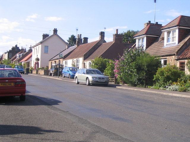
Edgehead (also known as Chesterhill) is a village in Midlothian, Scotland.
Contents
- Map of Edgehead Pathhead UK
- Location
- History
- Edgehead Colliery
- Naming
- Facilities
- Historic buildings
- Transport
- References
Map of Edgehead, Pathhead, UK
Location
Edgehead is situated east of Dewartown and Mayfield, north-west of Pathhead and south-east of Dalkeith. Two areas of woodland, Windmill Wood and Chesterhill Wood, are located beside the northern end of the village.
History
The village developed along the long straight Roman road Dere Street, and remains linear in nature. It expanded in the 19th century when a coal mine was opened in Windmill Woods. The village once contained four shops supplying both residents and local farms. It was designated a conservation area by Midlothian Council in 1982, and redesignated following a review in 1996. The population of Edgehead was 115 in August 2008.
Edgehead Colliery
Edgehead Colliery was a coal mine located in Windmill Woods in the 19th and 20th century. It was initially owned by the Earl of Stair. Around 1930 ownership transferred to the Fordel Mains (Midlothian) Colliery Company, and it became part of the National Coal Board in 1949 and was closed in 1959. In 1842 the mine employed 127 workers; by 1959 this had fallen to 40.
Naming
Although the village is often called Edgehead, this name is in fact technically applied only to the farmhouse located at the top of the hill. The correct name for the remainder of the village is Chesterhill. Chesterhill is descended from an ancient cattlefold which later became a Roman camp; Edgehead literally means "fold".
Facilities
Edgehead has no local shops as of 2010. A small park and children's play area is located near the top of the village. A telephone box and letter box are found near the top of the village.
Cranston Primary School was located at the south of the village. In 2004 it had 57 pupils. However it has since been closed following the opening of a number of new primary schools in Midlothian and the site sold for redevelopment.
Historic buildings
Edgehead contains three listed buildings:
Transport
Edgehead is located on a minor road which runs from Pathhead to join an unnumbered road north of Whitehill which leads to Dalkeith. The road into Dalkeith previously formed part of the trunk A68 road, but was bypassed in September 2008 to relieve traffic congestion in Dalkeith town centre. There is some evidence from 17th-century maps to suggest that the road through Edgehead was part of the main route between Edinburgh and Lauder now part of the A68. It was originally part of the Roman road Dere Street, which ran from York to Cramond.
The village is served by Perryman's Buses bus routes 51 (Edinburgh-Jedburgh) and 52 (Edinburgh-Kelso), which combine to provide an hourly service in each direction Monday to Saturday daytimes.