
Country England County Lincolnshire Status Parish | Primary council South Kesteven Region East Midlands UK parliament constituencys Grantham, Stamford | |
 | ||
Website Edenham, Grimsthorpe, Elsthorpe & Scottlethorpe Parish Council | ||
Edenham, Grimsthorpe, Elsthorpe and Scottlethorpe is a civil parish in South Kesteven, Lincolnshire, England. The population of the civil parish at the 2011 census was 291.(For ref see Edenham) It is principally located in the valley of the East Glen which flows through Edenham.
Contents
Geology
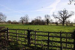
The broad valley is incised into a gently sloping and much dissected plateau of glacial till which is more graphically described by the older term, boulder clay. The till caps the ridges to either side, the one clothed by the Bourne Woods and the other by the park of Grimsthorpe Castle. All the solid geology is Jurassic. The valley sides are of Kellaways clay, Kellaways sand and Oxford clay while its bottom is of cornbrash and Blisworth clay. In the south and west of the parish are much greater exposures of this solid geology with extensive areas of Blisworth Limestone and the Upper Estuarine Series. In the valley, there are also strips of alluvium and patches of glacial sand and gravel.
Although Grimsthorpe Castle is on higher ground to the west, the village of Grimshtorpe shares the geology of the rest of the parish.
Constituent Settlements
The main village is
The parish includes a number of outlying hamlets
The parish is associated with two lost settlements:
Aislestorp is mentioned in the Domesday book as belonging to Alfred of Lincoln and having a mill, 5 villagers, all Freemen; 2 ploughlands. 1 lord's plough team, 2 men's plough teams; 18 acres of Meadow, and 240 acres of Woodland. Sunken roads, building plots, and a fishpond have been located at the site of the original settlement.
Sudtorp is mentioned in the Domesday book as belonging to Guy of Craon and having a mill, 10 villagers, of whom 6 were smallholders; 2 ploughlands. 2 lord's plough teams, 2 men's plough teams; 16 acres of Meadow, and 200 acres of Woodland. The village is mentioned from the time of the Domesday Survey onwards. There was a chantry chapel here in the 12th century. A priest was last instituted at Southorpe in 1521, and, by 1563, one family only remained.
Administration
Once part of the Beltisloe Wapentake in Kesteven, the parish is now part of South Kesteven District. Its obligations under the 19th century poor law were undertaken by the Bourne Poor Law Union from 1835 onwards.
The present Electoral arrangements are as follows:
The Ecclesiastical parish follows the same boundaries, and is part of the Deanery of Beltisloe, preserving the old Wapentake boundaries.
Businesses
Apart from agricultural employers there is a post office, coal merchant and agricultural dealer.