
Elevation 30 m (100 ft) Postcode 6100–6118 Area 104.6 km² Local time Friday 11:05 PM | Established 1 January 2003 Time zone CET (UTC+1) Area code 046, 0475 Team EVV | |
 | ||
Weather 5°C, Wind E at 6 km/h, 77% Humidity Points of interest Museum, Avonturenpark Valdeludo, Stichting Dierenpark Echt | ||
Echt-Susteren (Dutch pronunciation ; Limburgish: Ech-Zöstere) is a municipality in the southeastern Netherlands. Echt-Susteren was created in 2003 by merging the former municipalities of Echt and Susteren.
Contents
Map of Echt-Susteren, Netherlands
Susteren is situated in a Euregional area. In the west the municipality borders to Belgium and in the east to Germany. The narrowest is only 4.8 km wide. It is possible to walk from Germany to Belgium via Netherlands in under an hour. The area of Echt-Susteren is a green municipality also known as the green waist of Limburg.
Population centres
Aasterberg, Baakhoven, Berkelaar, Dieteren, Echt, Echterbosch, Gebroek, Heide, Hingen, Illikhoven, Kokkelert, Koningsbosch, Maria-Hoop, Nieuwstadt, Oevereind, Ophoven, Oud-Roosteren, Peij, Pepinusbrug, Roosteren, Schilberg, Sint Joost, Slek, Susteren, Visserweert.
Dutch Topographic map of the municipality of Echt-Susteren, June 2015
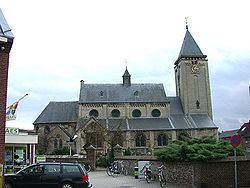
Echt
Echt is a former municipality. It received city rights in 1343.
Susteren
Susteren is a former municipality. It received city rights in 1276.
Maria-Hoop
Maria-Hoop is a small village in the neighbourhood of the hamlets Echterbosch and Putbroek and the village Koningsbosch. Originally named Diergaarde, the village's named was changed to Maria-Hoop in 1953, after the local church Moeder der H. Hoop.
Roosteren
The name of the village of Roosteren (population circa 1600, including Kokkelert and Oevereind) was derived from a combination of the Rode Beek (Red Brook) and the town of Suestra (Susteren) leading to the name Roosteren. The village has two 'castles', the Castle Ter Boch and the Castle Eyckholt and a number of Lord Manors. It is located in between the Meuse River (Maas River) and the Juliana Canal (Juliana Kanaal) with a small part of the village separated from the main population centre by the canal: Oud Roosteren (Old Roosteren). The main church is located in Roosteren whereas the cemetery is located near the site of the former church in Old Roosteren.