
Local time Friday 8:15 PM | ||
 | ||
Weather 29°C, Wind S at 16 km/h, 79% Humidity Restaurants Canada Restaurant, ibro chops place, Canadah Food Resturant, De Honey Fast Food, Lilly White Hotels Mainland Hotel, Moonshine Hotel, Eskab Hotel, Imperial Suite, Sean Gate | ||
market city jodiesorrell s photos around ebute metta nigeria market in ebute metta lagos
Ebute Metta is a neighbourhood of Lagos Mainland, Lagos, in Lagos State, Nigeria.
Contents
- market city jodiesorrell s photos around ebute metta nigeria market in ebute metta lagos
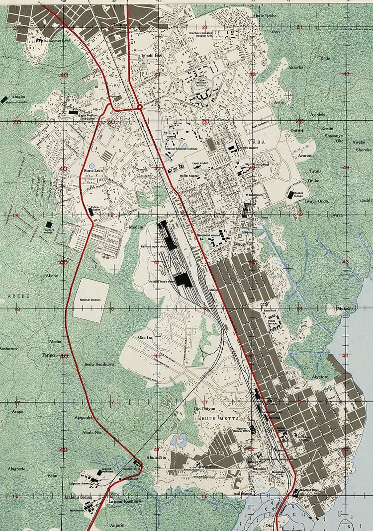
- Map of Ebute Metta Lagos Nigeria
- Name
- History
- Buildings
- Transport
- References
Map of Ebute-Metta, Lagos, Nigeria
Name
Ebute Metta is a Yoruba word for a place known as three shores. Ebute means shore and meta means three.
History
Ebute Metta is known for the production and sale of local food and cloths. It is a very old part of Lagos, many of its houses were built during the colonial era, using Brazilian architecture. The area includes the St Jude's church and school, African Salem church/school, and the Salvation Army church. The imposing Lisabi Hall leads to the Okobaba area with its lagoon background.
Buildings
Ebute Metta has a number of notable buildings including the Nigerian Railway Corporation headquarters, post offices, St Paul's Catholic Church, the Oyingbo market, a major bus terminal, Foucos Secondary School (a school built by the former minister for education), St. Saviour's School, Junior Strides Academy, Ajayi Memorial Hospital, Ebute Metta Health Centre, and shops of all types. Ebute Metta is divided into two main areas: East and West.
Transport
Ebute Metta is a main access route linking mainland Lagos to the three main islands of Victoria, Ikoyi and Lagos Island. A major network of fly overs and access roads connects these various parts of Lagos as you drive through the Iddo peninsula.