
Country Elevation 420 m Population 11,750 (Dec 31, 2008) Area 9.68 km2 | District Mayor Gemeindeprasident | |
Ebikon is a municipality in the district of Lucerne in the canton of Lucerne in Switzerland.
Contents
- Map of Ebikon
- Gasthaus schweizerheim ebikon country inn with garden restaurant restaurants switzerland
- Ebikon 16 07 2011
- History
- Geography
- Old world food and charm at swiss chalet
- References
Map of Ebikon
Gasthaus schweizerheim ebikon country inn with garden restaurant restaurants switzerland
Ebikon 16 07 2011
History
Ebikon was first mentioned during the late 9th Century as marcha Abinchova.
Geography
Ebikon has an area of 9.7 km2 (3.7 sq mi). Of this area, 38.4% is used for agricultural purposes, while 23.9% is forested. Of the rest of the land, 30.3% is settled (buildings or roads) and the remainder (7.3%) is non-productive (rivers, glaciers or mountains). In the 1997 land survey, 23.94% of the total land area was forested. Of the agricultural land, 34.06% is used for farming or pastures, while 4.33% is used for orchards or vine crops. Of the settled areas, 15.69% is covered with buildings, 1.75% is industrial, 1.55% is classed as special developments, 1.14% is parks or greenbelts and 10.22% is transportation infrastructure. Of the unproductive areas, 4.13% is unproductive standing water (ponds or lakes), 2.58% is unproductive flowing water (rivers) and 0.62% is other unproductive land.
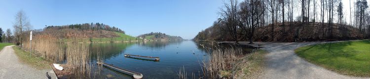
The municipality is located along the old highway between Lucerne and Zurich. It consists of the linear village of Ebikon and the greater part of the Rotsee or Red Lake, the upper Ron valley (Rontal) and the town section of Rathausen.