
 | ||
Restaurants Joe Jost's, Pizza X Two, El Sauz, The Crooked Duck, 39 Degrees Hotels Days Inn Long Beach Cit, Royal Inn Motel Long Beach, Grace Hotel, Argunant Hotel, Long Beach Inn | ||
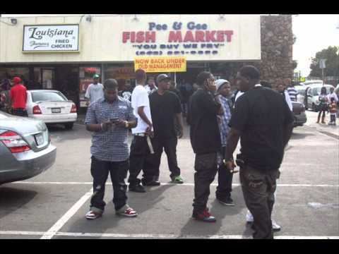
The term Eastside or East Side has two different meanings in the city of Long Beach, California. The first, and more current meaning, refers to an area roughly comprising the eastern half of the city, usually excluding areas south of the east-west line made by Pacific Coast Highway/Atherton Street. This area is also called East Long Beach. The second usage refers to the "Eastside" made famous in 1990s hip-hop/gangsta rap. This area is on the east side of the Los Angeles River, and is roughly centered on the Poly High and Central Area neighborhood, north of Downtown Long Beach.East Side Long Beach is populated with the East Side Longo,Rollin 20s Crip,Insane Crip, Barrio Pobre,Asian Boyz,Mid City Stoners,18st,and many more.The East Side Longo and Tiny Rascal Gang (TRG),have been engaged in a deadly feud since the 1990s after a group of Tiny Rascal gang members shot and killed a 16-year-old Longo in 1989.
Contents
Map of Eastside, Long Beach, CA, USA
East Long Beach
East Long Beach is a large area of Long Beach, roughly comprising the eastern geographic half of the city, but usually excluding areas south of the east-west line made by Pacific Coast Highway/Atherton Street. East Long Beach is generally taken to extend north to the northern city boundary and east to the eastern city boundary. Areas east of the 605 Freeway and the San Gabriel River such as El Dorado Park near Orange County form the easternmost boundary. The western boundary is less well-defined, given variously as Lakewood Boulevard, and the Long Beach Municipal Airport to form part of the western boundary.
The neighborhood consists of all or portions of the 90815, 90808 and 90803 ZIP codes and is adjacent to the Traffic Circle, the California State University, Long Beach campus, the Los Angeles County cities of Lakewood and Hawaiian Gardens, and the Orange County cities of Cypress and Los Alamitos.
"Eastside" Long Beach
The "Eastside" neighborhood of Long Beach is located on the east side of the Los Angeles River and 710 Freeway (closer to the center of Long Beach). The boundaries for this second Eastside are (very roughly) Willow Street and the Signal Hill city limits (N), Ximeno Ave. (E), Seventh St. (S), and the Los Angeles River (W).
Rappers Snoop Dogg, Knoc-Turn'al, Warren G, Nate Dogg, Daz Dillinger, Goldie Loc, Tray Deee, Soopafly, Bad Azz, RBX, Twinz, Techniec, Lil C-Style, Lil' ½ Dead, Crooked I, Domino, The Dove Shack as well as Snoop Dogg's Tha Eastsidaz, are all from Eastside Long Beach. The VIP Records store which has been featured in music videos by Snoop Dogg and other rap music artists is at the corner of Pacific Coast Highway and Martin Luther King Jr. Blvd. in Eastside Long Beach, which has recently been closed.
This term "Eastside" is a neighborhood area that encompasses many smaller neighborhoods, including several of the official Historic Districts designated by the City of Long Beach and the Cambodia Town district. The area is often referred to as "Central Long Beach" by newspapers, city officials and real estate agents, but the term "Eastside". The area's major thoroughfares are Anaheim Street, Pacific Coast Highway (State Route 1) and 7th Street east to west; and Pacific Avenue, Long Beach Boulevard and Atlantic Avenue north to south. The LA Metro Transit Authority Blue Line light rail runs in the center of Long Beach Boulevard beginning at Willow Ave and has stops throughout the neighborhood. Most streets are fairly narrow, and usually lined with cars throughout the day, as many residents of the area do not have a garage or assigned parking space available. The architecture of the neighborhood varies, it may include craftsman-style homes and bungalows dating back to the pre-WWII era, as well as small apartment complexes built during and shortly after the war. What little newer housing exists in the neighborhood is generally built from public funds as part of various urban renewal efforts by the City; an example of this are the townhouses along Atlantic Ave north of Pacific Coast Highway in an area referred to as "Renaissance Square" by City Hall. While there are no large-scale public housing projects on the East Side, the neighborhood has several "workforce housing" areas, as well as many smaller apartment complexes and other dwellings that are owned by the city Housing Authority or subsidized by public funds to offer lower rents. Overcrowding is evident in the neighborhood, it is frequent to see a three or four-unit apartment structure standing behind an older house on the same lot. There had been some gentrification of the area in the 2000s, due to its relative proximity to the beach (the beachfront is walking distance from many areas of the Eastside), the downtown and the CSU Long Beach Campus. Developers bought up several apartment complexes in the area and converted them into condominiums, only to see housing demand collapse in the 2007/2008 housing slump, causing many of these developments to sit empty for long periods of time. The Eastside is also marked by heavy small-business retail activity, especially in the storefronts that line Anaheim Street, 7th Street and Pacific Coast Highway. Many of these businesses are owned by immigrants and include restaurants, discount clothing stores, and automotive repair shops. So many businesses along a stretch of Anaheim Street are owned by Cambodian immigrants that the city has named the area "Cambodia Town".
The East Side Longo and Tiny Rascal Gang (TRG),have been engaged in a deadly feud since 1990s after a group of Tiny Rascals killed a 16-year-old Longo in 1989
The neighborhood includes all or portions of ZIP codes 90813, 90806, 90804, 90802 and 90815. It is adjacent to Downtown Long Beach, Alamitos Beach, Belmont Heights, Wrigley and the Traffic Circle, as well as Central Long Beach.