
Population 1,567 (2011) Civil parish Eastington Local time Friday 2:20 PM UK parliament constituency Stroud | OS grid reference SO774053 Sovereign state United Kingdom Dialling code 01453 | |
 | ||
Weather 14°C, Wind SW at 13 km/h, 73% Humidity | ||
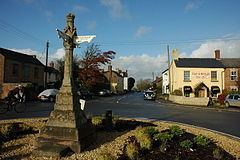
Eastington is a village and civil parish in the English county of Gloucestershire. It lies 4 miles west of Stroud and 9 miles south of Gloucester at the entrance to the Stroud Valley. It is situated west of the town of Stonehouse and is convenient for Junction 13 of the M5 motorway and the A38 and A419 roads. Since the M5 and its access roads were opened, the main road no longer runs through the village.
Contents
Map of Eastington, Stonehouse, UK
Amenities
Eastington has a number of farms and former mills.
There are a small number of retail outlets including a Co-op, a butchers, two pubs, two hairdressers, and a garage. There is also a village hall, where the brownie pack and rainbow pack meet, and a primary school, which has about 120 students. There is also a community building where Eastington playgroup and various clubs are held. At nearby Claypits there is a farm shop which sells oil and animal feed, and a coach company.
The nature reserve of Five Acre Grove lies close to the village and is designated a Key Wildlife Site (KWS).
Religion
There are two churches, one Church of England, and the other a Methodist.
Governance
The village is part of 'Eastington and Standish' electoral ward. This ward starts in the south west at Eastington and follows the M5 motorway north eastwards to Standish. The total ward population taken at the 2011 census was 1,794.