
Highest point Kangto | Mountains Kangto, Nyegyi Kansang | |
 | ||
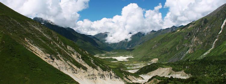
Five days in the eastern himalaya the sandakphu to phalut trek
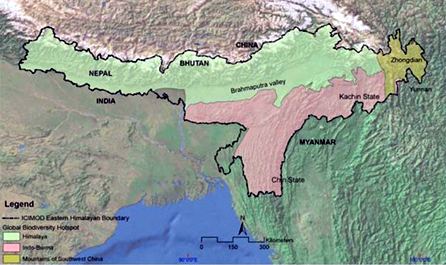
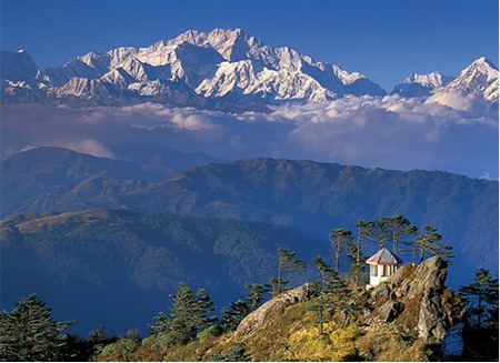
The Eastern Himalayas are situated between the Kali Gandaki River in Central Nepal in the west and Myanmar in the east, occupying southeast Tibet in China, Sikkim, North Bengal, Bhutan and North-East India. These Himalayas have been declared as a biodiversity hotspot by Conservation International.
Contents
- Five days in the eastern himalaya the sandakphu to phalut trek
- Eastern himalayas ancient risks future threats
- Structure and relief
- Climate
- Agriculture
- Political divisions
- Wildlife
- References
Eastern himalayas ancient risks future threats
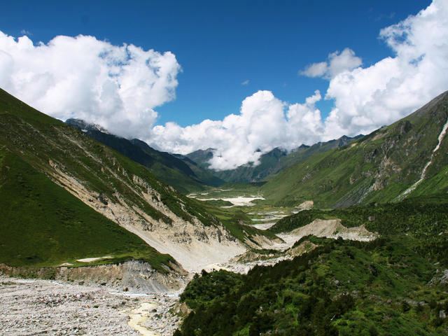
Structure and relief
The Eastern Himalayas have a much more sophisticated geomorphic history and pervasive topographic features than the Central Himalayas. Nepal - a country which contains 8 out of the 10 highest mountains in the world - features, among other rare animal species, snow leopards in the Himalayan region and one-horned rhinos and Asian elephants in the Southern region, making the country one of the world's greatest biodiversity hotpots. The three major river basins of Nepal, namely the Karnali Basin, the Narayani Basin and the Koshi Basin feature highly dense forests, which boast no less than 5% of the world's butterfly species and 8% of the world's bird species.
In the southwest of Sub-Himalayas the Singalila Ridge, the western end of a group of uplands as in Nepal known as the Higher-Himalayas and the Sub-Himalayas. Most of the Sub-Himalayas are in Nepal; however, a small range reaches into Sikkim, and a fragment comprises the southern half of the Bhutan. The Buxa range of Indo-Bhutan belongs to the ancient rocks of the Himalaya. The ancient folds mainly along east-west axes were worn down, during a long period of denudation lasting to cretaceous times, possibly a hundred million years. During this time the carboniferous and Permian rocks disappeared from the surface, except in the north near Hatisar in Bhutan and in the long trench extending from Jaldhaka River to Torsa River, where limestone and coal deposits are preserved in discontinuous basins. Limestones appear also in Bhutan on the southern flanks of lower Himalayas. The rocks of the highlands are mainly sandstones of the Devonian age, with limestones and shales of the same period in places. The core of the mountain is exposed across the centre, where Paleozoic rocks, mainly Cambrian and Silurian slates and Takhstasang gneiss, outcrop in the north-west and north-east, in the later extending into western region of Arunachal Pradesh. In the Mesozoic era the whole of the worn-down plateau was under sea. In this sea, which covered most of Assam, Bhutan, chalk was deposited as a result of oscillations between land and sea levels, during subsequent periods of the tertiary rocks were laid down. Paro metamorphic belt may be found overlying Chasilakha-Soraya gneiss in some places. Silurian metamorphics in others shows that there must be long denudation of the surface. This was the time of the Alpine mountain building, and much of the movement in the palaeozoic region was probably connected with it. The Chomolhari tourmaline granites of Bhutan stretching westwards from the Paro chu, but at a greater depth below the present surface belong to this period of uplift, fracture and subsidence.
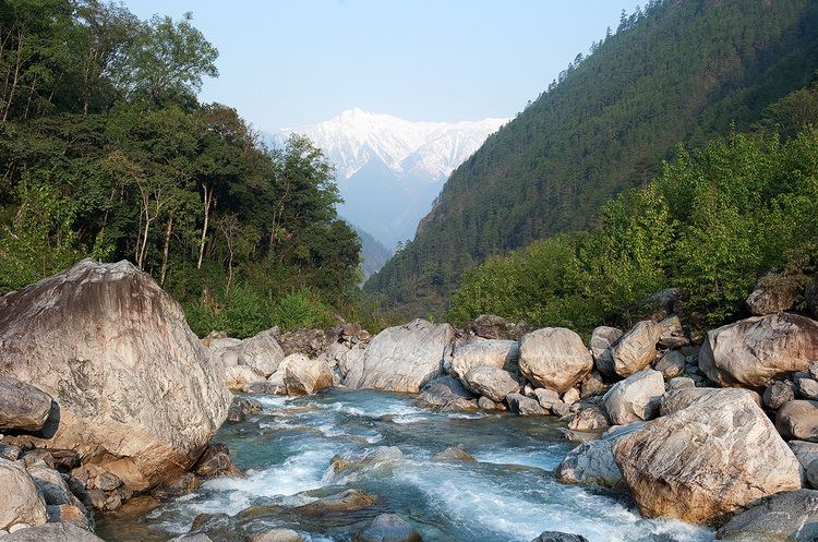
Climate
The climate of Eastern Himalaya is characterized by cool summer and chilly winter. The hot season commences about the middle of April, reaches its maximum in the month of June and lasts till the end of August. The average temperature generally recorded is 20 C. The average rainfall in the area is about 500mm. Snowfall is a usual phenomenon in the higher altitudes.
The effect of snow accumulation in the valleys of Rangeet, Teesta, Chumbi is very remarkable in reducing the temperature. In winter, most of the precipitation falls in the form of snowfall. Thus the North-East monsoon is the predominant feature in Eastern Himalayan region, while on the southern slopes the cold season precipitation is more important.
Agriculture
Agriculture conditions vary in different parts of the region. In the highlands of Eastern Himalaya the soil is morainic, and the hill slopes are embanked into successive steps or terraces, only a few meters broad, on which spring crops are grown abundantly. Agriculture predominated by shifting cultivation, supplemented by hunting, fishing and barter trade are characteristics of the region. Agricultural produce is not sufficient for local feed. Economy remained stagnant for centuries due to lack of capital market, entrepreneurship and avenues of investment.
Political divisions
Eastern Himalaya can be divided into five distinguished regions;
Wildlife
There is a diverse array of wildlife in the Eastern Himalayas. Animals such as the Asian Elephant and the Wild Water Buffalo call this place their home. Preserving this wilderness will ensure that many animals thrive and can continue to grow their numbers.