
Abolished January 1, 2010 Time zone EET (UTC+2) Area 48,726 km² | Established September 1, 1997 ISO 3166 code IS Population 569,832 (31 Dec 2009) | |
 | ||
Points of interest Olavinlinna, Linnansaari National Park, Retretti, Koli National Park, Puijo tower Destinations | ||
Eastern Finland was a province of Finland from 1997 to 2009. It bordered the provinces of Oulu, Western Finland and Southern Finland. It also bordered Russia to the east.
Contents
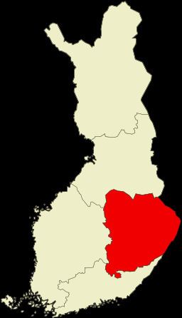
- Map of Eastern Finland Finland
- History
- Administration
- Regions
- Municipalities in 2009 cities in bold
- Governors
- Heraldry
- References
Map of Eastern Finland, Finland
History
On September 1, 1997, the Mikkeli Province, the Kuopio Province and Northern Karelia Province were joined to form the new Eastern Finland Province.
All the provinces of Finland were abolished on January 1, 2010.
Administration
The State Provincial Office was a joint regional authority of seven different ministries. It promoted national and regional objectives of the State central administration. Eastern Finland State Provincial Office had branch offices in Mikkeli, Joensuu, and Kuopio.
Regions
Eastern Finland was divided into three regions:
Municipalities in 2009 (cities in bold)
Eastern Finland was divided into 54 municipalities in 2009.
Governors
Heraldry
The coat of arms of Eastern Finland was composed of the arms of Savonia and Karelia.