
Country Hong Kong Constituencies 37 Area 18.9 km² | Region Hong Kong Website District Website | |
 | ||
University Hong Kong Shue Yan University Points of interest Hong Kong Museum of Coastal D, Alexander Grantham, Law Uk Folk Museum, Quarry Bay Park, Hong Kong Film Archive | ||
The Eastern District (Chinese: 東區) is one of the 18 districts of Hong Kong. It had a population of 588,094 in 2011. The district has the second highest population while its residents have the third highest median household income among 18 districts.
Contents
Map of Eastern District, Hong Kong
Geography
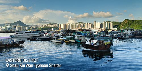
It is located in the north-eastern part of the Hong Kong Island and includes the areas of Fortress Hill, North Point, Quarry Bay, Shau Kei Wan, Heng Fa Chuen, Chai Wan and Siu Sai Wan.
The eastern portion of Causeway Bay and Tin Hau were once in Eastern District. They were moved to Wan Chai District in the new year day of 2016.
History
Originally a backwater of fishing villages, quarries and dockyards, there are archaeological evidence there were villages and small towns appeared during the Song Dynasty (AD. 960 - AD 1279).
The Eastern District is now mostly residential, with some industrial areas and several large shopping malls. While most Home Ownership Scheme and public housing estates are located from Sai Wan Ho to Chai Wan, large private housing estates are located within the eastern district, such as Taikoo Shing, Kornhill and Heng Fa Chuen. A commercial hub has been developed from the former industrial areas in western part of Quarry Bay. Hotels and commercial buildings are also developed near Fortress Hill along the coast.
In the past the district was linked by a single King's Road, which was notoriously congested during peak hours, this had largely been solved by the constructions of the Island Eastern Corridor, the Island Line within the MTR rapid transit system in the 1980s and it contains the long-historied tram line that stretches from Shau Kei Wan towards other districts near the sea shore.