
Area 150,210 km² | ||
Turkey introduction film of turkey eastern anatolia region
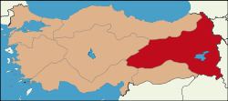
The Eastern Anatolia Region (Turkish: Doğu Anadolu Bölgesi) is a geographical region of Turkey.
Contents
- Turkey introduction film of turkey eastern anatolia region
- Turkish traditions klarnet dance eastern anatolia region version
- Substitution with Armenia
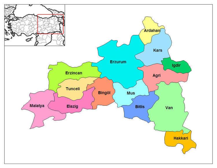
- Subdivision
- Provinces
- Location and borders
- Population
- Geography
- Climate and nature
- References
The region and the name "Doğu Anadolu Bölgesi" were first defined at the First Geography Congress in 1941. It has the highest average altitude, largest geographical area, and lowest population density of all regions of Turkey. Prior to getting its current name by the Turkish state, most of the region was part of the Six Armenian provinces in the region known as the Armenian Highlands. After the Armenian Genocide, the geopolitical term "Eastern Anatolia" was created to replace what had historically been known as Western Armenia.
Turkish traditions klarnet dance eastern anatolia region version
Substitution with Armenia
Starting from 1880 the name Armenia was forbidden to be used in official Ottoman documents. The government of Sultan Abdul Hamid II replaced the name Armenia with such terms as "Kurdistan" or "Anatolia". The Sublime Porte was trying to cover up the Armenian Question; if there was no Armenia, then there was no Armenian Question. The process of “nationalization” of toponyms was continued by the Kemalists, who were the ideological successors of the Young Turks, and gained momentum during the Republican period. Starting from 1923 the entire territory of Western Armenia was officially renamed “Eastern Anatolia” (literally The Eastern East).
In the 17th century when the Armenian Question was not as yet included into the international diplomacy agenda, the terms "Anatolia" or "Eastern Anatolia" were never used to indicate Armenia. Furthermore, the "Islamic World Map" of the 16th century and other Ottoman maps of the 18th and 19th centuries have clearly indicated Armenia (Ermenistan) on a specific territory as well as its cities.
Armenia, together with its boundaries, was unequivocally mentioned in the works of earlier Ottoman historians and chroniclers until the end of the 19th century. Kâtip Çelebi, a famous Ottoman chronicler of the 17th century, had a special chapter titled “About the Country Called Armenia” in his book Jihan Numa. When, however, this book was republished in 1957, its modern Turkish editor H. Selen changed this title into “Eastern Anatolia”. Osman Nuri, a historian of the second half of the 19th century, mentions Armenia repeatedly in his three-volume Abdul Hamid and the Period of His Reign.
The word Anatolia means “sunrise” or “east” in Greek. This name was given to the Asia Minor peninsula approximately in the 5th or 4th centuries B.C. During the Ottoman era, the term Anadolou included the north-eastern vilayets of Asia Minor with Kyotahia as its center. The numerous European, Ottoman, Armenian, Russian, Persian, Arabic and other primary sources did not confuse the term Armenia with Anatolia. This testifies, inter alia, to the fact that even after the loss of its statehood the Armenian nation still constituted a majority in its homeland, which was recognized by Ottoman occupiers as well.
Subdivision
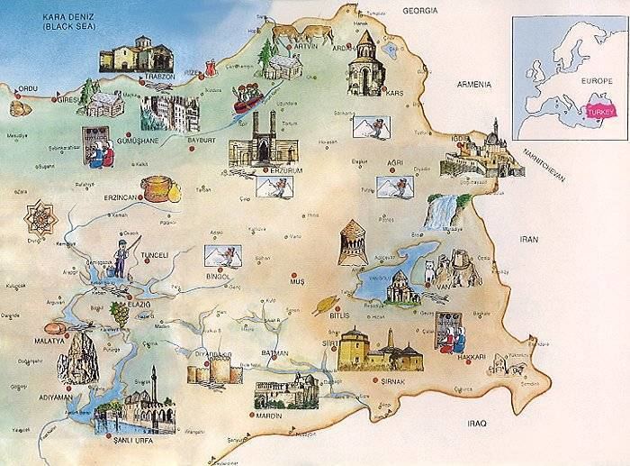
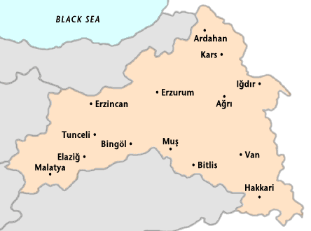
Provinces
Provinces that are entirely in the Eastern Anatolia Region:
Provinces that are mostly in the Eastern Anatolia Region:
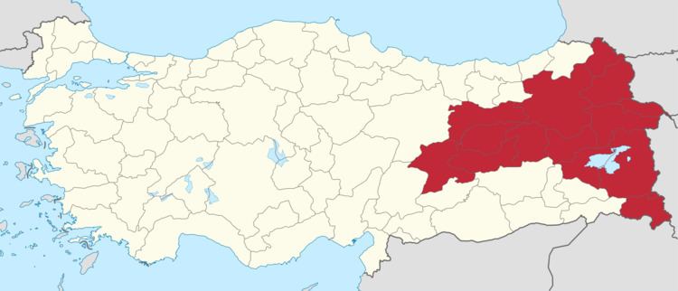
Location and borders
The Eastern Anatolia Region is located in the easternmost part of Turkey. It is bounded by Turkey's Central Anatolia Region to the west; Turkey's Black Sea Region to the north; Turkey's Southeast Anatolia Region and Iraq to the south; and Iran, Azerbaijan, Armenia and Georgia to the east, where Eastern Anatolia overlaps and converges with the South Caucasus region and Lesser Caucasus mountain plateau.
The area of the region is 146,330 km², which comprises 18.7% of the total area of Turkey.
Population
The total population of the region is 6,100,000 (2000 census) and 5,906,565 (2014 estimate). The region has the second most rural population of Turkey after the Black Sea region. The migration level (to the other regions, especially to Marmara Region) is high and population density (40 person/km²) is lower than the average for Turkey (98 person/km²). The migration toward other Turkey's regions and toward foreign countries is higher than the natural population increase, a fact which is leading to a slight decline of the Region's population.
Geography
The average altitude is 2,200 m. Major geographic features include plains, plateaus and massifs. There is some volcanic activity today.
Massifs and mountains
Plateaus and plains
Lakes
Rivers
Climate and nature
Since most of the region is far from the sea, and has high altitude, it has a harsh continental climate with long winters and short summers. During the winter, it is very cold and snowy, during summer the weather is cool in the highlands and warm in the lowlands. The region has the lowest average temperature of all Turkish regions, with -25 °C. Although it can get below -40 °C. The summer average is about 20 °C.
The region's annual temperature difference is the highest in Turkey. Some areas in the region have different microclimates. As an example, Iğdır (near Mount Ararat) has a milder climate.
The region contains 11% percent of the total forested area of Turkey, and it is rich in native plants and animals. Oak and yellow pine trees form the majority of the forests.
The region has high potential for hydroelectric power.