
Population 246 (2011) Post town LEYBURN | OS grid reference SE145860 Sovereign state United Kingdom Local time Friday 10:20 AM | |
 | ||
Weather 7°C, Wind S at 11 km/h, 88% Humidity | ||
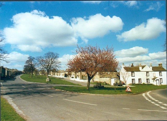
East Witton is a village and civil parish in Wensleydale in North Yorkshire, England. It lies south of Leyburn, in the Richmondshire district. Richard Whiteley is buried there; he and his partner, Kathryn Apanowicz, lived in the village.
Contents
Map of East Witton, Leyburn, UK
The village lies at the mouth of Coverdale. The River Cover and the River Ure are on the northern boundary of the parish. The parish also includes Jervaulx Abbey, 1.8 miles (2.9 km) east of the village, and Braithwaite Hall, a 17th-century manor house owned by the National Trust, 1.8 miles (2.9 km) west of the village.
The western part of the parish is in the Yorkshire Dales National Park. Most of the eastern part is in the Nidderdale Area of Outstanding Natural Beauty.
History
East Witton was originally known simply as Witton, and was mentioned (as Witun) in the Doomsday Book. The name is Old English, from widu and tūn, meaning "wood settlement", suggesting a place where wood was felled or worked. By the late 12th century the village became known as East Witton to distinguish it from another Witton, now known as West Witton, 5 miles (8 km) further up Wensleydale.
The village was originally sited along what is now Lowthorpe (which leads to the site of the old church (St Martin in the Field). It acquired a town charter (and is shown on olderOS maps as East Witton Town) in 1307, and a market. During the Black Death, the market was moved to Ulshaw Bridge and died out shortly thereafter. A market was mentioned again in 1728, but subsequently lapsed. The Earl of Ailesbury, owner of the Jervaux estate, rebuilt most of East Witton in the early 19th century, the houses and gardens in the same places as they were in 1627 according to an old estate map. In 1809 a church was built by the road on the new site on the east of the village; it replaced the old church of St Martin, the site of which is now covered in trees and contains the tomb stone of conjoined twins.
The village green is complete with three village taps, with mains water being installed in most houses in the late 1950s from the new Sowden Beck pumping station.
The parish of East Witton was historically divided into the townships of East Witton Within or East Witton Town (the village and Braithwaite) and East Witton Without or East Witton Out (which included Jervaulx Park, Witton Moor and Colsterdale). The townships became separate civil parishes in 1866. In 1886 Colsterdale was transferred from East Witton Without to Healey with Sutton, and became a separate civil parish in 1894. Until 1934 the parish also shared the uninhabited Masham Moor with the ancient parish of Masham. In 1934 the moor was divided between the civil parishes of Colsterdale, Healey and Ilton cum Pott.
In 1974 the parishes of East Witton Town and East Witton Out were transferred to the new county of North Yorkshire. In 2002 the two parishes were abolished to create the new combined parish of East Witton.
Popular culture
East Witton is featured in the British television series All Creatures Great and Small, in the episode "The Prodigal Returns", as the home of the two Mrs Altons.