
Time zone AEST (UTC+10) Founded 1976 | Formation 1976 Area 15,724 km² | |
 | ||
Districts ListGazelle DistrictKokopo DistrictPomio DistrictRabaul District Website www.eastnewbritain.gov.pg University Papua New Guinea University of Natural Resources and Environment | ||
Japanese ww2 underground hospital east new britain province papua new guinea
East New Britain is a province of Papua New Guinea, consisting of the north-eastern part of the island of New Britain and the Duke of York Islands. The capital of the province is Kokopo, not far from the old capital of Rabaul, which was largely destroyed in a volcanic eruption in 1994. East New Britain covers a total land area of 15,816 square kilometres (6,107 sq mi), and the province's population was reported as 220,133 in the 2000 census, rising to 328,369 in the 2011 count. Provincial coastal waters extend over an area of 104,000 square metres (26 acres).
Contents
- Japanese ww2 underground hospital east new britain province papua new guinea
- Map of East New Britain Province Papua New Guinea
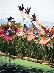
- Nathan nakikus live at png games 2012 rabaul east new britain province
- Districts and LLGs
- References
Map of East New Britain Province, Papua New Guinea
There are sixteen Austronesian languages spoken in the province, of which Kuanua, spoken by the Tolai on the Gazelle Peninsula is the most widely spoken.
East New Britain has a dual economy: a cash economy operates side by side with the subsistence-farming sector. The main crops produced for export are cocoa and copra. Tourism continues to be an increasingly important sector of the provincial economy.
Nathan nakikus live at png games 2012 rabaul east new britain province
Districts and LLGs
Each province in Papua New Guinea has one or more districts, and each district has one or more Local Level Government (LLG) areas. For census purposes, the LLG areas are subdivided into wards and those into census units.