
 | ||
Fox sports outdoors preview 16 2016 east matagorda bay texas speckled trout fishing
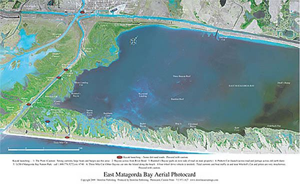
East Matagorda Bay, off Matagorda County on the Texas coast (at 28°43' N, 95°49' W), is enclosed by the Matagorda Peninsula and the tidal flats at the mouth of the Colorado River. Its only true opening to the Gulf of Mexico is through Brown Cedar Cut, near the north end of the peninsula.
Contents
- Fox sports outdoors preview 16 2016 east matagorda bay texas speckled trout fishing
- Map of East Matagorda Bay Texas USA
- Fox sports outdoors southwest 16 2016 east matagorda bay texas speckled trout fishing
- References
Map of East Matagorda Bay, Texas, USA
It is part of the Matagorda Bay system, the third largest estuarine system in the state of Texas.
Fox sports outdoors southwest 16 2016 east matagorda bay texas speckled trout fishing
References
East Matagorda Bay Wikipedia(Text) CC BY-SA