
OS grid reference TF336624 Post town Spilsby | Sovereign state United Kingdom Local time Friday 6:46 AM | |
 | ||
Population 303 ( Including Hagnaby. 2011) Weather 4°C, Wind S at 11 km/h, 89% Humidity | ||
Giant 1 4 scale rc english electric lightning with twin turbines ted at lma raf east kirkby 2015
East Kirkby is a village and civil parish in the East Lindsey district of Lincolnshire, England. It is situated 7 miles (11 km) south-east from Horncastle, and on the A155 road.
Contents
- Giant 1 4 scale rc english electric lightning with twin turbines ted at lma raf east kirkby 2015
- Map of East Kirkby Spilsby UK
- References
Map of East Kirkby, Spilsby, UK
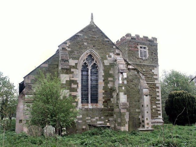
East Kirkby 13th century Grade II* listed Anglican parish church is dedicated to St Nicholas. The church tower and nave arcades are of Decorated style, and the chancel screen, Perpendicular. In the south aisle is a 14th century slab to Sir Robert Sylkestone (d. 1347), founder of the chantry.
A Wesleyan chapel was established in 1862.
East Kirkby was the birthplace of Thomas Goodrich, or Goodricke, (1494–1554). Goderich was Bishop of Ely (1533–54) and Lord High Chancellor of England from 1551.
East Kirkby has a disused 1820 Grade II listed tower mill. The village's public house is the Red Lion on Fen Lane.
The Prime Meridian passes just to the east of East Kirkby through the former RAF East Kirkby airfield, which has a meridian marker. The airfield was a Second World War Royal Air Force station, part of which now houses the Lincolnshire Aviation Heritage Centre.