
Country Indonesia Website timur.jakarta.go.id Province Jakarta | Time zone WIB (UTC+7) Area 188 km² | |
 | ||
Weather 31°C, Wind NW at 11 km/h, 72% Humidity Colleges and Universities Jakarta State University, The Christian University, Indonesian College of Technology, Jayabaya University, Universitas Ibnu Chaldun | ||
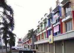
Enjoy jakarta 2013 east jakarta
East Jakarta (Indonesian: Jakarta Timur) is a city within Jakarta Special District, Indonesia. It had a population of 2,687,027 at the 2010, making it the most populous of the five cities within Jakarta.
Contents
- Enjoy jakarta 2013 east jakarta
- Map of East Jakarta East Jakarta City Jakarta Indonesia
- All ages party east jakarta hardcore 1989 2009 documentary
- Subdistricts
- Transportation
- Economy
- Education
- References
Map of East Jakarta, East Jakarta City, Jakarta, Indonesia
East Jakarta is bounded by North Jakarta to the north, Bekasi to the east, Depok to the south, and South Jakarta and Central Jakarta to the west.
The governor's office is located in the Administrative Village (Kelurahan) of Jatinegara, in the Jatinegara Subdistrict.
All ages party east jakarta hardcore 1989 2009 documentary
Subdistricts
East Jakarta is divided into 10 subdistricts:
Transportation
Economy
Aviastar Mandiri has its head office in East Jakarta.
In the past, in East Jakarta, there are 23 Sugar mills such as Setu, Jatiwarna, Ceger, Kalijereng, Pedongkelan (Cimanggis), Palsigunung, Klender, Pondokjati and Cibubur is open in 1914 and is closed due to the 1997 financial crisis.
Sugar mills is open first is Klender ((Dutch): Suikerfabriek Klender) in 1905.
Education
Schools include:
John Calvin International School was formerly in East Jakarta from 2007–2008.