
Basin size 15 sq mi (39 km) Source elevation 181 m | Length 4 km Country United States of America | |
 | ||
Main source Lake Lashaway614 feet (187 m) River mouth Quaboag Pond594 feet (181 m) Discharge Average rate:11.5 cu ft/s (0.33 m/s) | ||
The East Brookfield River is a 2.4-mile-long (3.9 km) river in Massachusetts that heads at Lake Lashaway in East Brookfield at an elevation of 614 feet (187 m) above sea level. It continues to Quaboag Pond, at an elevation of 594 feet (181 m).
Contents
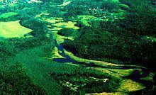
Map of East Brookfield River, East Brookfield, MA, USA
History
This river receives its name from East Brookfield, Massachusetts. Via the Quaboag River, it is part of the Chicopee River Watershed.
Watershed
This river starts at the Lake Lashaway Dam, near State Route 9 and continues through wetlands to Quaboag Pond. Numerous local brooks and streams from the towns of East Brookfield, North Brookfield, and Spencer drain the watershed into Lake Lashaway and the East Brookfield River. About one mile from its mouth at Quaboag Pond, the Seven Mile River joins, draining water from Spencer and surrounding areas.