
Surface elevation 282 m | ||
 | ||
Similar | ||
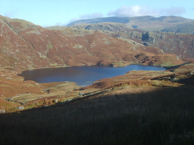
Easedale tarn lake district uk 2004
Easedale Tarn is a tarn in the centre of the English Lake District, about two miles west of the village of Grasmere. It lies in a hollow between Tarn Crag to the north and Blea Rigg to the south, about 910 feet or 280 metres above sea level. The hollow was formed by a small corrie glacier, and is believed to have filled with water around 11,000 years ago when the ice finished melting.
Contents
- Easedale tarn lake district uk 2004
- Map of Easedale Tarn Ambleside UK
- Waterfalls towards easedale tarn lake grasmere 29june2015
- References
Map of Easedale Tarn, Ambleside, UK
Easedale Tarn is one of the larger tarns in the district, about 480 metres long and 300 metres wide. Its outflow is Sourmilk Gill, named after the milky white colour of its waterfalls, which runs east towards Grasmere. The gill displays impressive water scenery when seen from Grasmere, and from the path to the tarn.
The tarn is a popular destination for walkers. Many people climb the path from Grasmere which overlooks Sourmilk Gill. The ascent was popular during the Victorian period, and a refreshment hut was even established in the 19th century by Robert Hayton of Grasmere above the outlet of the tarn to service the thirsty visitors. The hut is long gone, and nettles now grow where the ruins used to be.