
Opened 1902 Bridge type Truss bridge | Maintained by State of Iowa Closed 1983 Location Dubuque Body of water Mississippi River | |
 | ||
Carries 2 lanes of US 61 / US 151 Similar Dubuque–Wisconsin Bridge, Sabula Rail Bridge, Gateway Bridge, Black Hawk Bridge, Lock and Dam No 11 | ||
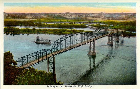
The Eagle Point Bridge was a very narrow two lane automobile bridge that connected urban Dubuque, Iowa and rural Grant County, Wisconsin. It was part of the US 61/US 151 route, and was a toll bridge. After the new Dubuque-Wisconsin Bridge was built in 1983, the Eagle Point Bridge was torn down. At the end, the toll was ten cents, both ways, collected on the Iowa side.
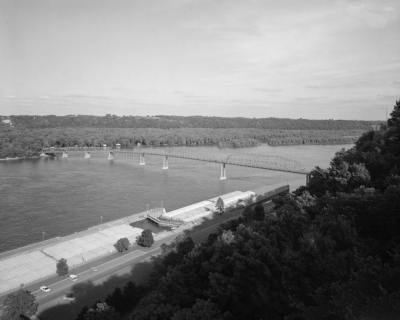
The bridge was located about 900 feet south of Lock and Dam No. 11, at the northern edge of Rhomberg Avenue in Dubuque, and connected to Eagle Point Road on the opposite side of the river. It was about one mile (2 km) north of the present bridge. In 1968, the highway designation was removed from the bridge and a four-ton load limit was put in place. The bridge was still structurally sound after the new bridge was built, leading some to ask the bridge be kept open as a pedestrian or special use bridge, but the state of Iowa still tore the bridge down.
Several years after the demolition of the bridge, a restaurant known as the Tollbridge Inn was constructed at what was the Iowa end of the bridge. The restaurant operated for a number of years, until it was torn down to make way for future development.
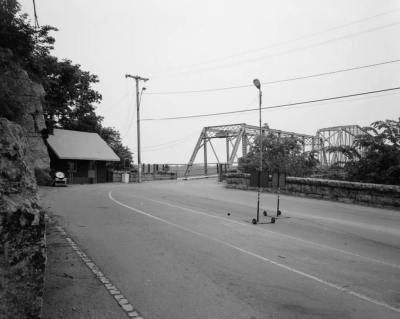
The bridge was extensively documented in 1982 for the Library of Congress Historic American Engineering Record. The survey consists of 81 black-and-white photos and 45 data pages detailing construction and history of the bridge.