
District South West Delhi Area 56.48 km² | State Delhi Time zone IST (UTC+5:30) Lok Sabha constituency West Delhi Pin code 110075 | |
 | ||
Weather 24°C, Wind NE at 13 km/h, 41% Humidity Colleges and Universities Guru Gobind Singh Ind, Netaji Subhas Institute o, National Law University, Deen Dayal Upadhya, University School of Manage | ||
Dwarka is a neighbourhood of Delhi and is located in the district of South West Delhi in India.
Contents
- Map of Dwarka New Delhi Delhi
- History
- Parks
- Location
- Sanitation
- Crime
- Transportation
- Cultural hub
- Mixed land use concept
- Social infrastructure
- Primary and secondary schools
- Universities and Colleges
- References
Map of Dwarka, New Delhi, Delhi
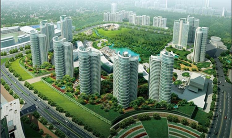
Dwarka is organised into Cooperative Group Housing Societies. It is one of the most sought-after residential areas in the city. It has the largest rooftop solar plant in Union Territory of Delhi.
In January 2017, Cabinet of India approved Dwarka to be second Diplomatic Enclave for 39 countries on 34 hectares, after Chanakyapuri. In 2016, Cabinet of India chaired by PM Narendra Modi has approved 89.72 hectares of land for Exhibition-cum Convention centre.
Dwarka is being developed as a smart city under Delhi Development Authority's ‘smart sub-city’ project.
History
It is named after the legendary Dwaraka Kingdom. It is a short distance away from Gurugram which is a major hub for large corporations in the country and about 10 km away from Indira Gandhi International Airport. With the opening up of the Airport Express Line, the travel time from the Dwarka Sector 21 Metro station to Airport is expected to be about 3 minutes.
Some parts of modern-day Dwarka historically came under the colony of Pappan Kalan, which are now developed under the 'Urban Expansion Projects' of the Delhi Development Authority.
A small baoli, discovered five years ago in Dwarka, has been restored and could become a tourist attraction. An elaborate conservation project by the India National Trust for Art and Cultural Heritage (Intach) for the Lodi-era baoli was completed recently. Dwarka Baoli ( also known as Loharehri Baoli ) is a historical stepwell recently discovered in Dwarka Sub City, in south west New Delhi, India. It was constructed for the residents of Loharehri village by the Sultans of the Lodi Dynasty in the early 16th century. Dwarka now stands where the Loharehri village once stood.
Parks
Delhi Development Authority is currently planning to establish a theme-based park, to be spread over 200 acres in sector 20.
Location
Currently Dwarka Sub-City (Sector 1 to 29) is divided into 5 MCD Wards: 135- Kakraula, 136- Matiala, 141- Bijwasan, 145- Palam, and 147- Mahavir Enclave. Dwarka is divided into three Assembly Constituencies i.e. AC-34 Matiala, AC-36 Bijwasan, AC-37 Palam. Also, Dwarka is divided into two Parliamentary constituencies i.e. West Delhi and South Delhi. The area of Dwarka Sub-city as per DDA record is 5648 Hectares. The density of population is around 160-200 per H A. Road length in Dwarka is 396 km.
Sanitation
The irregularity in transportation of garbage and the South Delhi Municipal Corporation failing to clean Dwarka, has recently caused the city to face a severe sanitation crisis.
The Delhi High Court has been looking into the issue of lack of sanitation and cleaning in Dwarka since 2014.
Civic agencies such as DDA and the municipal corporation have blamed Dwarka filth on ‘lack of civic sense’.
Crime
Due to lack of streetlights and police patrolling, empty roads and absence of security guards in most colonies, there have been reported incidents of petty street crimes.
Transportation
Cultural hub
Dwarka sub-city is emerging as a cultural hub of the south-west Delhi. Most notable among the cultural centres in Dwarka is the Rukmini Dwarkadhish Temple, also known as the ISKCON temple. This temple in the Sector 13 is a centre of worship, intellectual deliberations and social interactions.
Mixed land use concept
DDA has implemented the unique concept of Mixed Land Use (MLU) in Dwarka. Most of the DDA housing clusters in Dwarka have commercial buildings in close proximity. In many sectors, approximately 80% of a plot is used for residential flats and the rest 20% for commercial purpose. This unique MLU concept provides lots of convenience to the occupants of Dwarka DDA flats, as they get the facility of shopping, dining and purchasing grocery in close proximity.
Social infrastructure
The sub-city has been planned for an environment of convenience which contains essential facilities and services at different levels mainly health, education, hotel, safety and security, cultural, and communication etc.
In reality however, the social infrastructure of Dwarka may at best be considered average. The key areas of concern in this regard include the poor levels of sanitation (especially garbage disposal), dismal condition of internal roads and footpaths, and a very low level of police (including Traffic Police) presence.
The most striking aspect is the absence of an entertainment infrastructure in the sub city. Currently there is no Multiplex or aesthetically appealing entertainment complex to cater to the present residing population. A city center has been planned, and construction is in final stages.
Primary and secondary schools
Dwarka is home to many primary and secondary schools along with engineering and law institutes like Netaji Subhas Institute of Technology, Times Institute of Management & Engineering Studies, Guru Gobind Singh Indraprastha University and National Law University, Delhi.
Universities and Colleges
Faculty of Law, University of Delhi is planning a new campus in Dwarka and will be building hostels for students and residential quarters for staff members.