
Country India District North 24 Parganas PIN 743248 Population 89,850 (2011) | State West Bengal Time zone IST (UTC+5:30) Telephone code 2536-**** Local time Wednesday 4:08 PM | |
 | ||
Weather 23°C, Wind SE at 10 km/h, 84% Humidity | ||
Duttapukur is a census town under Barasat I (community development block) of Barasat sadar subdivision in North 24 Parganas district in the Indian state of West Bengal.
Contents
- Map of Nebadhai Duttapukur West Bengal
- Geography
- Demographics
- Administration
- Education
- Higher secondary schools
- Secondary schools
- Primary School
- National Award winner teachers
- Village
- Healthcare
- Economy
- Banks
- Other Important Offices
- Climate
- Railway
- Roads
- CTC Buslines
- DN Series of Routes
- MMMN Series of Routes
- Bus Routes without Numbers
- STA Bus Routes
- References
Map of Nebadhai Duttapukur, West Bengal
Geography
Duttapukur is located in the GangesBrahmaputra delta region in the district of North 24 parganas, West Bengal state in the eastern India. A tributary of Bidyadhari River known as Suti flows through Duttapukur. Duttapukur is 30 km from Sealdah & 35 km from Howrah , 7 km from Barasat and 32 km from Bongaon on the Sealdah-Bangaon section of Eastern Railway
Demographics
As of 2011 India census, Nebadhai Duttapukur (a census town within Duttapukur region) had a population of 25,557; of this, 12,902 are male, 12,655 female .
As of 2011 India census, Duttapukur had a population of 79,815 (at proper Duttapukur Area). Males constitute 51% of the population and females 49%. Duttapukur has an average literacy rate of 77%, higher than the national average of 59.5%: male literacy is 82%, and female literacy is 73%. In Duttapukur, 9% of the population is under 6 years of age.
Administration
Duttapukur falls under the jurisdiction of Duttapukur Police Station (Formerly under Barasat PS Judiciaries ). Duttapukur is a census town under Barasat I (community development block) of Barasat sadar subdivision. Duttapukur I and Duttapukur II gram panchayats are responsible for development of Duttapukur. It falls under the Assembly constituency of Amdanga (Vidhan Sabha constituency) and Barrackpore (Lok Sabha constituency).
Other Offices of the Government or Government Owned Companies that helps the town by providing other facilities:-
Education
There are many primary and higher secondary schools. Most of the schools, in the town, are run by the state government. All of the secondary schools are affiliated to the West Bengal Board of Secondary Education and the higher secondary schools are affiliated to the West Bengal Council of Higher Secondary Education. Students usually choose from one of three streams — Arts, Commerce, or Science, though vocational streams are also available. Institute for higher education is not available in Duttapukur. Students have to go to nearby towns like Barasat, Madhyamgram, Birati, Habra or to Kolkata to attend college.
Higher secondary schools
Secondary schools
Primary School
National Award winner teachers
"National Teacher" award from Govt. of India was awarded to two of the well known teachers and social workers.
Village
Healthcare
North 24 Parganas district has been identified as one of the areas where ground water is affected by arsenic contamination. In this connection, Rotary Club of Calcutta has taken a project purifying the rain water is to be given to the Kashimpur Boys & Girl’s High school both.
Local clubs also conducts health awareness programmes.
Economy
The proximity to Kolkata helps residents commute daily to Kolkata. Most of the people earns their living doing services in various central government, State Govt. or non-govt. companies. Besides two large markets known as Duttapukur Station Market and Hatkhola Bazar. Duttapukur have four nos of Daily Vegetable Market at Nebadhai, Duttapukur Station,Duttapukur Hatkhola & Gangapur Area. Side by side it's also have two nos of Bi-weekly Hat at Duttapukur Hatkhola (One of the largest Vegetable-Fruits & Fish Market for bulk cum retail customer in 24pgs(North)) & Jublighata Hat. Recently Govt of West Bengal open a new Vegetable Market at Gangapur. (i.e. Duttapukur Krishi Biponi Kendra).One new Shopping Mall has opened at Duttapukur Talikhola(Near Hatkhola) (i.e. Utsarga Bazar)
Six nos of Nationalised Banks & several ATMs are located at Duttapukur in different location.
Banks
ATMs:- United Bank of India ATM (1. Duttapukur Station Road, 2.Duttapukur Hatkhola ) Bank of India ATM (1. Duttapukur-Nilganj Road, Gangapur) State Bank of India ATM (1. Duttapukur Hatkhola- Hospital road, 2. Duttapur Hatkhola, 3. Nebadhai Bazar, 4. Hospital Road, Amantran More near DTK Rly Station), Bank of Baroda ATM (1.Duttapukur Hatkhola), ICICI Bank ATM(1. Duttapukur Hatkhola), Axis Bank ATM(1. Duttapukur Hatkhola & Duttapukur Station Road), HDFC Bank ATM(1. Duttapukur Hatkhola)
Other Important Offices
Climate
The climate is tropical — like the rest of the Gangetic West Bengal. The hallmark is the Monsoon — from early June to mid September. The weather remains dry during the winter (mid November to mid February) and humid during summer. Temperature :40 °C in May(Max) and 10 °C in January(Min) Relative Humidity: Between 55% in March & 98% in July Rainfall: 1,579mm(Normal)[6]
Railway
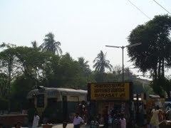
It is 30 km from Sealdah Station and 8 km from Barasat on the Sealdah-Bangaon branch line of Eastern Railway. It is part of the Sealdah Main section of the Kolkata Suburban Railway system. Duttapukur local, Habra local, Gobardanga local, Bangaon local Connects Duttapukur to Sealdah and other stations of Sealdah-Bangaon branch line. Duttapukur railway station has been selected to be constructed as a Model Station in the 2009 rail budget by Mamata Banerjee.
Roads
Duttapukur is connected to Kolkata and Bangladesh though land by Jessore Road (NH-35). Golabari-Duttapukur-Nilgange Road connects Duttapukur to Krishnanagar Road and Taki Road.
Duttapukur - Alampur directly Connects Duttapukur to Alampur Via Barasat, Rajarhat, 2nd Hoogly Bridge (MM5). Duttapukur - Dakshineswar directly Connects Duttapukur to Sodepur(MM3), Barrackpore(MM3), Dakshineswar(MM3), Barasat(MM3/1), Madhyamgram(MM3/1). Buses of Calcutta Tramways Company connects Duttapukur to Esplanade and Tollygunge through the city of Kolkata. Other private buses 78E, DN44, MN3, MN6, Thakurnagar - Alampur & Chakla - R.G. Kar Hospital connects Duttapukur to local towns like Habra, Bongaon, Maslandapur, Thakurnagar, Guma, Ashokenagar and Kolkata city using Jessore Road (NH-35). Buses of South Bengal State Transport Corporation from Habra connects Duttapukur to Durgapur, Kathi and Digha. Naihati, Madhyamgram, Nagarukhra, Kalyani, Basirhat, Kolkata, Bagdah, Chakdah, Digha, Durgapur, Baruipur, Howrah, krishnanagar, Behala, Dattaphulia, Nimta, Sodepur etc. all area in south Bengal are well connected to Duttapukur Via Barasat.
Netaji Subhas Chandra Bose International Airport, Kolkata is 22 km away from Duttapukur and connected through Jessore Road (NH-35).