 | ||
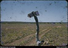
Durrie Station most commonly referred to as Durrie is a pastoral lease that operates as a cattle station in Queensland.
Contents
Description
It is situated about 91 kilometres (57 mi) east of Birdsville and 230 kilometres (143 mi) north of Innamincka. The Diamantina River and several of its associated tributaries run through the property. The 292 square kilometres (113 sq mi) Diamantina overflow swamp is situated on Durrie, the swamp is a DIWA nationally important wetland.
The property is currently owned by S. Kidman & Co. and occupies an area of 6,600 square kilometres (2,548 sq mi) in the Channel Country of far west Queensland. On an average season Durrie is stocked with 9,000 head of cattle and is managed by Darren Lorenz.
History
The traditional owners of the area are the Karwali peoples who have lived in the area for tens of thousands of years.
The property was established some time prior to 1897 when it was feared that ticks from cattle in the Northern Territory would infect the Queensland herd unless a quarantine line was formed.
Durrie was taken up in around 1908 by William Naughton, a prominent pastoralist of the time, when it took up an area of 2,000 square miles (5,180 km2) who stocked it over the course of two years with 8,000 head of cattle.
Kidman acquired Durrie in 1913 when he bought it from the Naughton Brothers. Durrie adjoined Monkira and Bluff Stations which were both already owned by Kidman.
The area was struck by drought from 1913 to early 1915 resulting in the deaths of huge numbers of stock. Kidman estimated that he lost 60,000 head on his properties in the Channel Country like Durrie, Diamantina Lakes, Durham Downs, Morney Plains and Carrawilla.
Airmail delivery to remote properties in outback South Australia, New South Wales and Queensland commenced in 1949. Durrie along with other remote properties including Mungerannie, Clifton Hills, Glengyle, Davenport Downs, Morney Plains, Mount Leonard, Mulka, Cordillo Downs, Tanbar, Durham Downs, Nappa Merrie, Lake Pure and Naryilco were also on the route.
After heavy rains in 1950 the Diamantina floodwaters reached records levels and the homestead was inundated. The McAuley family who were living at the homestead had to seek higher ground. The family camped on a nearby sand-hill for a week until the floodwaters receded.
Diamantina Overflow Swamp
The swamp extends over 25 kilometres (16 mi) long with a width of up to 22 kilometres (14 mi) that falls within the Diamantina catchment covering a total area of 292 square kilometres (113 sq mi). It is composed of floodplain, swamps and anastomosing channels of the Diamantina River composed of very deep grey cracking clays. The water in the swamp is fresh and remains wet well into the dry season. The major habitats found within the area include vast areas of lignum, Muehlenbeckia florulenta, open shrubland and of sedgeland dominated by Eleocharis between the lignum.
