
Criteria vii, viii, x Inscription 1980 (4th Session) Elevation 2,523 m | Type Natural Reference 100 Address Žabljak, Montenegro | |
 | ||
UNESCO region Europe and North America Hours Open today · Open 24 hoursWednesdayOpen 24 hoursThursdayOpen 24 hoursFridayOpen 24 hoursSaturdayOpen 24 hoursSundayOpen 24 hoursMondayOpen 24 hoursTuesdayOpen 24 hours Mountains Bobotov Kuk, Šljeme, Velika Rbatina, Šupljika Similar Hotel Soa, Ivan Do, Auto camp kod Boce, Ski, Hotel Jezera Zabljak | ||
Durmitor national park montenegro in hd
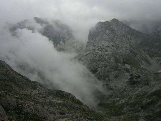
The Durmitor ([durmǐtɔr] [dǔrmitɔr]) is a massif that gave its name to a national park in northwestern Montenegro. The highest peak, Bobotov Kuk, reaches a height of 2,523 meters.
Contents
- Durmitor national park montenegro in hd
- Vrhovi balkana durmitor
- Peaks
- Lakes
- Name
- National park
- Tourism
- Maps
- References
The massif is limited by the Tara River Canyon on the north, the Piva River Canyon on the west, and by the Komarnica River Canyon on the south. To the east, the Durmitor opens to a 1,500 m (4,921 ft) high plateau, called Jezerska Površ (Plateau of Lakes). The Sinjavina mountain is located to the east of Jezerska Površ plateau.
The Durmitor mountain range is for the most part located in Žabljak municipality.
Vrhovi balkana durmitor
Peaks
The massif has 48 peaks above 2,000 m (6,562 ft). The highest peaks of Durmitor are:
Lakes
Durmitor features 18 glacial lakes, scattered over mountain massif and Jezerska Površ plateau. The lakes add significantly to the beauty of the mountain, and have been nicknamed Gorske Oči, or Eyes of the Mountain.
Name
Name Durmitor is probably derived from Balkan Romance-Vlach, and it means "sleeping place" (cognate with English dormitory). There are similarly named mountains such as Visitor (visător, "dreamer") and Cipitor (aţipitor, "sleeper") across former Yugoslavia.
National park
The Durmitor National Park, created in 1952, includes the massif of Durmitor, the canyons of Tara, Sušica and Draga rivers and the higher part of the canyon plateau Komarnica, covering the area of 390 km².
It was inscribed on the list of UNESCO World Heritage Sites in 1980.
80 kilometers long and 1,300 meters deep, the Tara River Canyon in the Durmitor National Park is the second largest in the world, after the Grand Canyon.
Tourism
Durmitor mountain is the centre of Montenegrin mountain tourism. The tourist facilities are concentrated around the town of Žabljak.
During winter, the main activities on Durmitor are skiing and, increasingly, snowboarding. In the summer, the activities shift to hiking, mountaineering and recreational tourism. One of the most prominent attraction of Durmitor mountain are 18 glacial lakes, best known being Crno Lake.