
Height 12 m | Length 692 metres (2,270 ft) Construction began 1955 | |
 | ||
Similar | ||
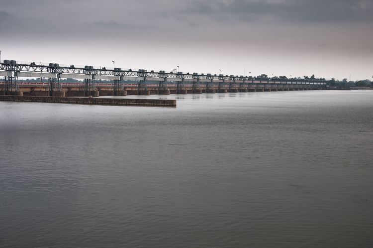
At durgapur barrage 27 09 09
Durgapur Barrage is across the Damodar River at Durgapur in Bardhaman district in the Indian state of West Bengal.
Contents
- At durgapur barrage 27 09 09
- Map of Durgapur Barrage Pratappur West Bengal 713218
- Overview
- The barrage
- The canals
- References
Map of Durgapur Barrage, Pratappur, West Bengal 713218
Overview
The Damodar River Valley Project on the Damodar River and its principal tributary, the Barakar River, is located in eastern India. The four main multipurpose dams located at Tilaiya, Konar, Maithon and Panchet were commissioned during 1953-1959. In addition, a single purpose reservoir on the main stream, the Damodar, at Tenughat was constructed later in 1974. While the four earlier dams are controlled by Damodar Valley Corporation, Tenughat Dam is controlled by the Government of Jharkhand. Durgapur Barrage, constructed downstream of all the dams, is controlled by the Government of West Bengal. Durgapur Barrage and the canal network, was handed over to the Government of West Bengal in 1964.
In 1932, the Anderson weir was constructed at Randiha. As a result, irrigation facility has been available in the lower Damodar basin before the advent of dams by means of the diversion weir on the Damodar River and Eden canal. It is about 19 kilometres (12 mi) downstream of Durgapur Barrage.
The barrage
Durgapur Barrage constructed in 1955 is 692 metres (2,270 ft) long. It has 34 gates (including under sluice). The size of gates are 18.3 m × 4.9 m (60 ft × 16 ft). The size of left and right under sluices are 18.3 m × 5.5 m (60 ft × 18 ft). Durgapur Barrage is 12 metres (39 ft) high.
The canals
The length of left bank main canal, originating from Durgapur Barrage, is 136.8 km (85.0 mi) and that of the right bank main canal is 88.5 km (55.0 mi). Discharge at head regulator for left bank canal is 260 cubic metres (69,000 US gal) per second and that for right bank canal is 64.3 cubic metres (17,000 US gal) per second. The total length of main and branch canals is 2,494 kilometres (1,550 mi).