
Quadrant NW Sector North Elevation 685 m | Ward 3 Area 222 ha Population 6,357 (2012) | |
 | ||
Restaurants Richard's Pub, Attila The HUNgry, Dunluce Steakhou & Pizza | ||
Dunluce is a residential neighbourhood located in the Castledowns area of north Edmonton, Alberta, Canada. It is named for a castle in Northern Ireland. The Castledowns Recreation Centre is located at the south east corner of the neighbourhood.
Contents
Map of Dunluce, Edmonton, AB, Canada
According to the 2001 federal census, most of the residential construction in the neighbourhood occurred during the 1970s and early 1980s. Approximately half (49%) of the residences are single-family dwellings. Another 19% are rented apartments, followed by row houses (18%), duplexes (10%) and mobile homes (5%). Almost two out of three (64%) are owner occupied with the remainder being rented.
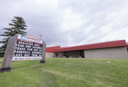
There are two schools in the neighbourhood: Dunluce Elementary School operated by the Edmonton Public School System and St. Lucy Catholic Elementary School operated by the Edmonton Catholic School System.
The neighbourhood is bounded by 127 Street on the west, Castledowns Road on the east, 167 Avenue on the north, 112 Street on the north east, and 153 Avenue on the south.
Demographics
In the City of Edmonton's 2012 municipal census, Dunluce had a population of 7003635700000000000♠6,357 living in 7003249100000000000♠2,491 dwellings, a -5.8% change from its 2009 population of 7003675100000000000♠6,751. With a land area of 2.22 km2 (0.86 sq mi), it had a population density of 7003286350000000000♠2,863.5 people/km2 in 2012.