
Population 2,054 (2011) Sovereign state United Kingdom | OS grid reference TF023792 Local time Wednesday 2:35 AM | |
 | ||
Weather 7°C, Wind S at 26 km/h, 97% Humidity | ||
Lord nelly demolition dunholme lincoln england
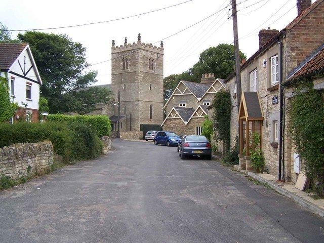
Dunholme is a village and civil parish in the West Lindsey district of Lincolnshire, England. It is situated on the A46 road, and 5 miles (8 km) north-east from the city and county town of Lincoln.
Contents
- Lord nelly demolition dunholme lincoln england
- Map of Dunholme Lincoln UK
- Lighting of queen elizabeth s birthday beacon in dunholme
- References
Map of Dunholme, Lincoln, UK
According to the 2001 census the village had a population of 1,681, increasing to 2,054 at the 2011 census.
Dunholme has a post office and village shop, and St Chad's CE Primary School on Ryland Road.
The parish church is dedicated to Saint Chad, and is a Grade I listed building, built in Early English style. It contains a kneeling effigy to Robert Grantham (died 1616), and was restored in 1856 and 1892.
RAF Dunholme Lodge airfield was used by RAF Bomber Command during the Second World War. It closed in 1964 and little remains, although the William Farr School was built on it.