
Intercommunality Le Dunois Area 50.09 km² | Population (2008) 3,942 Local time Wednesday 12:40 AM | |
 | ||
Weather 4°C, Wind SE at 8 km/h, 90% Humidity | ||
Dun-sur-Auron is a commune in the Cher department in the Centre region of France.
Contents
Map of 18130 Dun-sur-Auron, France
Geography
A farming area comprising a small town and a couple of hamlets situated by the banks of both the Auron River and the canal de Berry some 26 miles (42 km) east of Bourges at the junction of the D10, D14, D28, D34 and the D943 roads. Another small river, the Airain flows northwest through the northern part of the commune.
History
Dun-sur-Auron dates back from Dunum, a Gaul fortified place. In the Middle Ages it depended from the Vicecount of Bourges. In 1101, the last Vicecount, Eudes de Dun, sold his estates to King Philip I of France and the city was renamed Dun-le-roi.
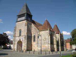
Sights
Personalities
References
Dun-sur-Auron Wikipedia(Text) CC BY-SA