
District 1st District Time zone PST (UTC+8) Area 88.48 km² | Barangays ZIP code 2921 Local time Wednesday 6:24 AM | |
 | ||
Weather 19°C, Wind E at 13 km/h, 86% Humidity | ||
Dumalneg is a fifth class municipality in the province of Ilocos Norte, Philippines. According to the 2015 census, it has a population of 2,947 people.
Contents
- Map of Dumalneg Ilocos Norte Philippines
- Geography
- Barangays
- Demographics
- Transportation
- Local government
- Government seal
- Attractions
- References
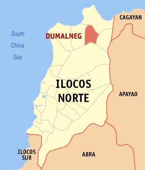
Map of Dumalneg, Ilocos Norte, Philippines
Until 2013 when the writ of execution was issued, Dumalneg was composed of only a single barangay of the same name. On August 10, 2012, the Supreme Court ruled in favor of Dumalneg in its territorial dispute with neighboring Bangui over the jurisdiction of Barangay San Isidro.
Geography
Dumalneg is border by Pagudpud in the north; Adams in the east; Vintar in the south and Bangui in the west. It has a land area of 88.48 km2 and it is a land-locked municipality. Nearly all parts of Dumalneg are mountainous. Only the starting of Dumalneg is well inhabited.
Barangays
Dumalneg is politically divided in 2 barangays:
Demographics
In the 2015 census, the population of Dumalneg was 2,947 people, with a density of 33 inhabitants per square kilometre or 85 inhabitants per square mile.
Dumalneg's population is predominantly made up of Ilocano and Apayao people.
Transportation
There are few jeepneys that are going to Dumalneg. Tricycles are the main transportation to the town. Dumalneg is a landlocked town, and the only way to get there is via the Dumalneg Road, starting on the highway in Brgy. Lanao, Bangui, to the Town's Proper.
Local government
As of the term 2013-2016, this are the elected officials of Dumalneg:
Government seal
Shield, derived from the provincial seal of Ilocos Norte
Red lettering, signifies the bravery of the legendary leader Apo Dumalneg and the Yapayaos
Background feathering, represents Mt. Quebrada, Mt Simmuda and the hills that surround Dumalneg
Orchids, symbolizes the municipal flower
Deers, represents wildlife that abounds in the municipality
Ribbon, depicts the peace-loving townspeople
Border of the Shield, represents rattan, the town’s forest product
Attractions
There are few attractions in Dumalneg. Mainly the Bolo River, locally known as "Ar-ar-o", the place where peoples of Bangui and Pagudpud also going in the said river. Also the view of the mountains of Vintar are considered also the town's attraction.