Country Belgium Area codes 015, 03 Area 22.71 km² Local time Tuesday 7:32 PM Governing party New Flemish Alliance | Postal codes 2570 Website www.duffel.be Postal code 2570 | |
 | ||
Weather 6°C, Wind W at 8 km/h, 76% Humidity Arrondissement Arrondissement of Mechelen | ||
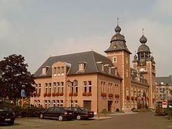
Duffel ( [ˈdɵfəl]) is a municipality in the Belgian province of Antwerp.
Contents
Map of Duffel, Belgium
The municipality comprises only the town of Duffel proper. On 1 January 2006, Duffel had a total population of 16,019. The total area is 22.71 km² which gives a population density of 705 inhabitants per km².
The town gives its name to a heavy woollen cloth used to make overcoats, especially for the armed forces, and various kinds of luggage. Items made from this material are sometimes spelled duffle as in duffle coat and duffle bag.
The etymology of Duffel is from "dubro" and "locus", from the Gaulish dubrum, dubron – “water”.
Notable natives
References
Duffel Wikipedia(Text) CC BY-SA
