
Peak unnamed summit | Elevation 150 m (490 ft) | |
 | ||
Age of rock Saale glaciation (ca. 140,000 years ago), reshaped during the Weichselian glaciation (ca. 20.000 Jahre), Tertiary rocks older than 5 MYA | ||
Quelle in den dubrower bergen
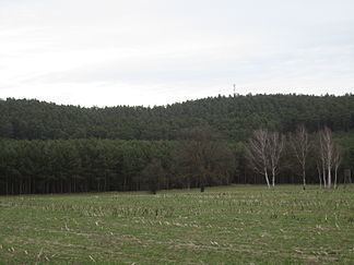
The Dubrower Berge are an ice age range of hills (end moraines) in the German state of Brandenburg. They lie about six kilometres southeast of Fürstenwalde/Spree in the county of Oder-Spree in the triangle between the villages of Langewahl, Alt Golm in the municipality of Rietz-Neuendorf and Neu Golm in the municipality of Bad Saarow.
Contents
Map of Dubrower Berge, 15518 Langewahl, Germany
The name is derived from the Slavic dub which means oak.
The Dubrower Berge are easy to reach from Berlin or Frankfurt/Oder on the A12 autobahn, just 2 kilometres to the north.
A transmission tower has been erected at their highest point, 150 metres above sea level (NN).
The extensive stands of woods and variety of landscapes in the Dubrower Berge and surrounding area are used by hikers and cyclists. Near the village of Langewahl in the Dubrower Berge is the Osterquelle spring.