
Length 432 km Country Australia | Basin area 26,019 km² | |
 | ||
Main source Caroline Ranges329 metres (1,079 ft) River mouth Napier Broome Baysea level Basin size 26,019 square kilometres (10,046 sq mi) Discharge Average rate:1,080,553 ML/a (34.2407 m/s; 1,209.197 cu ft/s) | ||
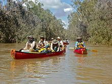
Touring australia king edward river to drysdale river
Drysdale River is a river in the Kimberley region of Western Australia.
Contents
- Touring australia king edward river to drysdale river
- Map of Drysdale River Western Australia Australia
- The kimberley episode 8 drysdale river part 1 all 4 adventure tv
- References
Map of Drysdale River, Western Australia, Australia
The river rises in the Caroline Ranges, flows in a northerly direction and discharges into Napier Broome Bay near Kalumburu. The river contains several permanent pools some of which have several examples of Indigenous Australian art known as Bradshaw paintings that can be found along the cliff faces.
Notable waterfalls on the river are the Eagle Falls - which are regularly visited by Kimberley coastal cruise ships, Solea Falls north of the Johnston Creek fork and Bango Falls on the tributary Bango Creek.
There are 19 tributaries of the Drysdale including; Gibb River, Woodhouse River, Barton River, Tadarida Creek, Wax Creek, Curlew Creek, King David Creek, Ubach Creek and Damper Creek.
15% of the river's catchment area lies within Drysdale River National Park.
The river was named after the Director of a Victorian Squatting Company T.A. Drysdale by explorer Charles Burrowes in 1886.
The traditional owners of the area that the river flows through are the Ngarinjin, Miwa and Wilawila peoples.