
Population 727 (2001 Census) Country Northern Ireland Postcode district BT17 Province Ulster Dialling code 028 | County County Down Sovereign state United Kingdom EU Parliament Northern Ireland Local time Tuesday 7:26 AM | |
 | ||
Weather 2°C, Wind S at 8 km/h, 89% Humidity | ||
Drumbeg (from Irish An Droim Beag, meaning 'the little ridge') is a small village, townland (of 376 acres) and civil parish on the south bank of the River Lagan in County Down, Northern Ireland. The village is covered by the Lisburn City Council area and forms part of the suburban fringe of Belfast.
Contents
Map of Drumbeg, Belfast, UK
Places of interest
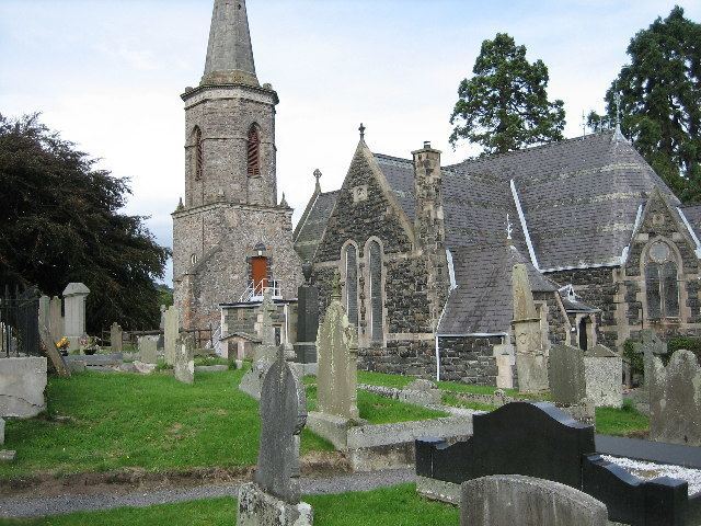
Of interest is the attractive Church of Ireland church (St. Patrick's) with its handsome lych-gate. The grave-yard attached to the church contains several interesting memorials.
2001 Census
Drumbeg is classified as a small village or hamlet by the NI Statistics and Research Agency (NISRA) (i.e. with population between 500 and 1,000). On Census day (29 April 2001) there were 727 people living in Drumbeg. Of these:
For more details see: NI Neighbourhood Information Service
Civil parish of Drumbeg
The civil parish covers areas in the historic baronies of Castlereagh Upper in County Down and Belfast Upper in County Antrim. It also contains the urban area of Dunmurry.
Townlands
The civil parish contains the following townlands: