
Elevation 2,282 m Mountain range Swiss Alps, Glarus Alps | Easiest route Hike Prominence 722 m | |
 | ||
Similar Fluebrig, Bös Fulen, Roggenstock, Silberen, Pfannenstock | ||
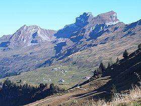
The Druesberg (or Drusberg) is a mountain located north of Pragel Pass in the Schwyzer Alps and the canton of Schwyz. It lies on the range between Unteriberg and Muotathal.
Map of Druesberg, 6436 Oberiberg, Switzerland
The skiing and hiking area Hoch-Ybrig lies to the north-west of the mountain summit, on the slopes into the valleys of the Minster and Waag rivers. To the north-east, the mountain is drained by the upper reaches of the Sihl, which eventually flows the centre of the city of Zürich.
References
Druesberg Wikipedia(Text) CC BY-SA