
Country United States County DuPage Time zone CST (UTC-6) Elevation 231 m Population 146,795 (2010) | State Illinois Settled November 6, 1849 Area 131.9 km² Local time Friday 9:34 PM | |
 | ||
ZIP codes 60439, 60480, 60514-60517, 60521, 60523, 60527, 60559, 60561 Weather -4°C, Wind NW at 13 km/h, 33% Humidity | ||
Downers Grove Township is one of nine townships in DuPage County, Illinois, USA. As of the 2010 census, its population was 146,795 and it contained 60,438 housing units. It is the largest township in the county, both in terms of area and population.
Contents
- Map of Downers Grove Township IL USA
- History
- Geography
- Cities towns villages
- Unincorporated towns
- Extinct towns
- Cemeteries
- Major highways
- Airports and landing strips
- Rivers
- Lakes
- Landmarks
- School districts
- Political districts
- References
Map of Downers Grove Township, IL, USA
History
Downers Grove Township is named for Pierce Downer, who settled in the neighborhood about 1830.
In the mid 1800's Dexter Stanley donated land to build the Oak Hill Cemetery. Along with the adjacent Oak Crest Cemetery, both are still used today as Township maintained Cemeteries.
Geography
According to the 2010 census, the township has a total area of 50.93 square miles (131.9 km2), of which 49.56 square miles (128.4 km2) (or 97.31%) is land and 1.36 square miles (3.5 km2) (or 2.67%) is water.
Cities, towns, villages
Unincorporated towns
(This list is based on USGS data and may include former settlements.)
Extinct towns
(These towns are listed as "historical" by the USGS.)
Cemeteries
The township contains these ten cemeteries: Cass, Clarendon Hills, Downers Grove, Fullersburg, Hinsdale Animal, Oak Crest, Oak Hill, Pierce Downer, Saint Johns Lutheran, Saint Mary of Gostyn and Saint Patricks Catholic.
Major highways
Airports and landing strips
Rivers
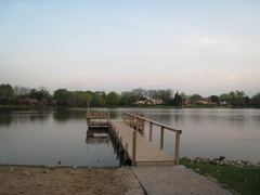
Lakes
Landmarks
School districts
Elementary School Districts: Butler 53, Cass 63, Center Cass 66, 180, Darien 61, Downers Grove Grade 58, Gower 62, Hinsdale 181, Lemont-Bromberek 113A, Maercker 60 High School Districts: CHSD 99, Hinsdale Township 86, Lemont Township 210 Unit School Districts: Westmont Community Unit School District 201