
Elevation 45 m (148 ft) Population 62,961 (31 Dec 2010) | Time zone CET/CEST (UTC+1/+2) Local time Friday 5:16 PM | |
 | ||
Weather 11°C, Wind E at 5 km/h, 48% Humidity Points of interest Knechtsteden Abbey, Feste Zons, Kreismuseum Zons, Burg Friedestrom, Tierpark Tannenbusch | ||
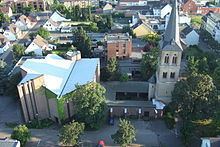
Dormagen is a town in North Rhine-Westphalia, Germany in the Rhein-Kreis Neuss.
Contents
- Map of Dormagen Germany
- Geography
- Division of the town
- History
- Economy
- Transportation
- Population
- Twin towns
- Persons of interest
- References
Map of Dormagen, Germany
Geography
Dormagen is situated between Düsseldorf – Cologne – Mönchengladbach on the western bank of the river Rhine.
Division of the town
Dormagen consists of 16 subdivisions (with population figure):
History
Dormagen was founded 50 AD. Its name was Durnomagus.
Economy
Its main industry and employer is the chemical factory of Bayer AG.
Transportation
The town has three stations (Dormagen, Nievenheim and Dormagen Chempark) on the Lower Left Rhine Railway, linking Cologne and Krefeld.
The German motorway 57 connects Dormagen with the same cities.
Population
¹ City of Dormagen
Twin towns
Persons of interest
References
Dormagen Wikipedia(Text) CC BY-SA