
Basin countries United States Average depth 24 feet (7.3 m) Surface elevation 1,618 m Mean depth 7.3 m Water volume 1.974 million m³ | Max depth 29 m Area 28 ha Shore length 2.7 km | |
 | ||
Lake type Natural, ultraoligotrophic Catchment area 1.1 square miles (2.8 km) | ||
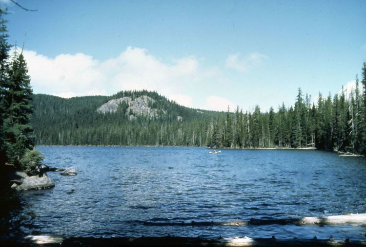
Doris lake ca
Doris Lake is a natural body of water in the Three Sisters Wilderness of the central Cascade Range in the U.S. state of Oregon. At 5,300 feet (1,600 m) above sea level, the lake is part of a volcanic landscape 27 miles (43 km) southwest of Bend and about 3 miles (5 km) by trail west of the Cascade Lakes Scenic Byway.
Contents
- Doris lake ca
- Map of Doris Lake Oregon 97413 USA
- Montage from blow and doris lake hike
- RecreationEdit
- References
Map of Doris Lake, Oregon 97413, USA
Doris Lake is west-southwest of Blow Lake and Elk Lake in the Deschutes National Forest. Other nearby lakes include Senoj and Leech. Doris Lake lies slightly east of the Lane County border and the Mink Lake Basin.
The lake is up to 95 feet (29 m) deep in a small basin carved by Pleistocene glaciers. No perennial streams enter or leave the lake, which is thought to gain and lose water through seepage.
Montage from blow and doris lake hike
RecreationEdit
The Six Lakes Trail, which runs by Doris Lake, connects the scenic byway to the east with the Pacific Crest Trail to the west. The trail offers opportunities for day hikes, backpacking, and horse riding.
Brook trout, stocked annually in the lake, grow to 14 inches (36 cm) here. Fishing is said to be "fair". Much of the lake is difficult to fish without a raft or float tube brought in along the trail.