
Country China Area 1,858 km² | Postal code 654100 Local time Friday 3:59 PM Area code 0871 | |
 | ||
Weather 14°C, Wind SW at 24 km/h, 45% Humidity Points of interest Dongchuan Forest Park, Xiyangyang Children Amusement Park, Guniushan, Hulifang | ||
Dongchuan District is a district under the jurisdiction of Kunming, Yunnan, China.
Contents
Map of Dongchuan, Kunming, Yunnan, China
History
Dongchuan was upgraded to a city in 1958. In 1998 Dongchuan was merged into Kunming and became one of its districts.
Geography
Dongchuan borders Sichuan.
The district's highest point, Jiaozi Snow Mountain, is 4330 meters high, and its lowest point is 695 meters. As of 2000 Dongchuan has a population of 275,564. As of 2006, the population was 302,000.
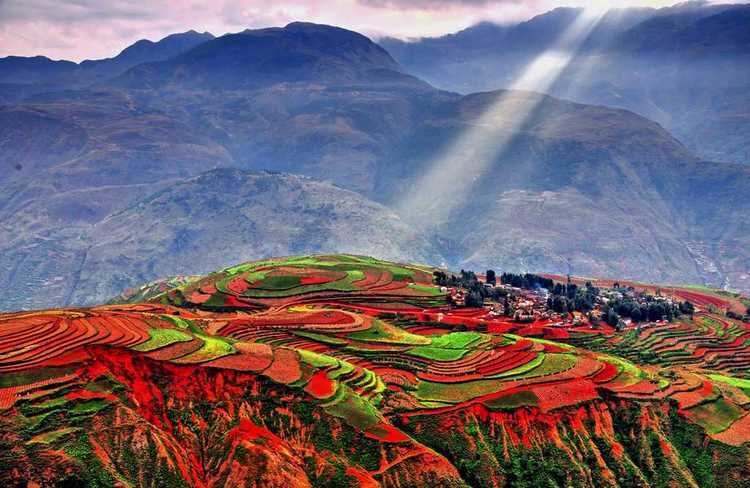
The area around Huagou in the Wumeng mountains has become famous through photographers who discovered the unique local landscape and its Red Earth scenery in the 1990s.
Administrative divisions
Copper Capital, A-wang, Wulong, Hongtudi, Tangdan, Tuobuka, Yinmin'ge Town and Shekuai Village
Economy
Dongchuan Special Industrial Park.
The Dongchuan mineral resource is rich and it has one of six biggest coppers bases in China. It is verified that there are 3.35 million tons of copper, accounting for a third of the copper reserves in the province.