
Nationality British Fields Landscape Archaeology | Name Dominic Powlesland | |
 | ||
Residence Yedingham, United Kingdom, Yorkshire, United Kingdom | ||
Dominic powlesland archaeological landscapes and digital geography talks at google
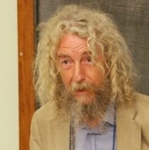
Dominic Powlesland (DUniv) (FSA) (1954-) is a British landscape archaeologist based in North Yorkshire. He has contributed to the methodologies of field archaeology and landscape survey, particularly geophysics and the use of computers when recording and processing archaeological data. He is the director of the Landscape Research Centre and visiting professor at the universities of York, Leeds, Huddersfield and Vienna. He was elected Fellow of the Society of Antiquaries of London in 2007 and in 2009 was elected Honorary Member of the Aerial Archaeology Research Group. He was awarded an honorary doctorate by the University of York in 2011 in recognition of his pioneering work in landscape archaeology and computer applications in archaeology.
Contents
- Dominic powlesland archaeological landscapes and digital geography talks at google
- Early life
- Career
- West Heslerton
- Landscape archaeology
- Computing and archaeology
- References

Early life
Powlesland was born in Romford (Essex) and began participating in archaeological excavations aged 11 in Colchester and continued through his teenage years.
Career
Powlesland's archaeological work has focused on the Vale of Pickering in Yorkshire. He has been working on this landscape since 1977, not only recording the archaeology but pioneering investigation techniques and methods that have influenced the discipline internationally. These include several major excavation projects and landscape investigations using geophysics, aerial photography and field survey methods. In 1984 Powlesland consolidated his team into the Landscape Research Centre, a charitable trust "dedicated to undertaking and disseminating archaeological research at a landscape scale".
West Heslerton
The West Heslerton project focused on the excavation of over 20 hectares (49 acres) of Anglo-Saxon settlement and cemetery. It was one of the largest and most detailed archaeological investigations ever conducted, recording more than 300,000 artefacts in three dimensions and comprehensively recording occupations from prehistory to well after the Anglo-Saxon occupation.
Landscape archaeology
Powlesland has advocated a detailed, landscape-scale approach to archaeology, arguing that studying sites in isolation misses the 'connective tissue' of past landscapes. The Landscape Research Centre has carried out this approach; for example studying 400 hectares (990 acres) of Vale of Pickering with geophysics, topographic and aerial survey, and the use of soil sampling for sediments and finds. The Heslerton Parish Project studied 10 square kilometres (3.9 sq mi) around the village of West Heslerton in order to set the excavations in context. It included multi-spectral aerial photography and geophysical magnetometer survey.
Computing and archaeology
Powlesland was an early adopter of computers as part of the archaeological recording process - beginning by writing his own programs for a Wang 2200 in 1982. Digital methods for recording, processing, analysing and presenting the results of archaeological research were developed and tested by Powlesland and his team throughout various projects. His work has been lauded by others in the field, particularly for the detailed three-dimensional recording of artefacts.