
Elevation 370 m Local time Thursday 6:42 PM | Region Ústí nad Labem Postal code 407 55 Area 15.44 km² | |
 | ||
Weather 6°C, Wind S at 10 km/h, 80% Humidity | ||
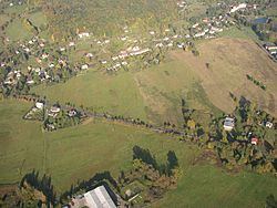
Dolní Podluží (German Niedergrund) is a village and municipality (obec) in Děčín District in the Ústí nad Labem Region of the Czech Republic (not to be confused with Niedergrund an der Elbe).
Contents
Map of Doln%C3%AD Podlu%C5%BE%C3%AD, Czechia
The municipality covers an area of 15.44 square kilometres (5.96 sq mi), and has a population of 1,199 (as at 2005).
Dolní Podluží lies approximately 32 kilometres (20 mi) north-east of Děčín, 46 km (29 mi) north-east of Ústí nad Labem, and 89 km (55 mi) north of Prague.
History
Until 1918, the town was part of the Austrian monarchy (Austria side after the compromise of 1867), in the RUMBURG (Rumburk) district, one of the 94 Bezirkshauptmannschaften in Bohemia.
The town name changed from NIEDERGRUND BEI WARNSDORF in NIEDERGRUND A.D. BÖHMISCHE NORDBAHN in May 1883.