- summer (DST) CEST (UTC+2) | Area 4.66 km² | |
 | ||
Sdh doln m cholupy video ze sezony 2014
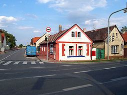
Dolní Měcholupy is a municipal district (městská část) and cadastral area (katastrální území) in Prague. It is located in the eastern part of the city. As of 2008, there were 1,788 inhabitants living in Dolní Měcholupy.
Contents
Map of 109 00 Prague-Doln%C3%AD M%C4%9Bcholupy, Czechia
The first written record of Dolní Měcholupy is from the 14th century. The village became part of Prague in 1968.
References
Dolní Měcholupy Wikipedia(Text) CC BY-SA
