
Population 554 (2011 census) | Postcode(s) 2229 Postal code 2229 | |
 | ||
Location 26 km (16 mi) south of Sydney CBD | ||
Dolans Bay is a suburb in southern Sydney, in the state of New South Wales, Australia, that is located 26 kilometres (16 mi) south of the Sydney central business district, in the local government area of the Sutherland Shire.
Contents
Map of Dolans Bay NSW 2229, Australia
Dolans Bay is on the north shore of the Port Hacking estuary. The suburb is named after the small cove on the edge of Burraneer Bay. Houses overlook the bay and some line the water's edge together with boatsheds. Boats are moored in the bay, which provides protection from the southerly wind. Burraneer Bay features a private marina and slipway with full repair facilities.
The suburb of Dolans Bay is surrounded by the suburbs of Caringbah, Lilli Pilli and Port Hacking. The suburb of Burraneer is located across Burraneer Bay. The villages of Maianbar and Bundeena are located on the opposite bank of Port Hacking.
History
Dolans Bay was named after a land owner in the area called Dominick Dolan. In 1858 Mary and Andrew Webster paid 108 pounds and 15 shillings plus a yearly peppercorn quit rent for their land in this area. The Websters sold their land to Dominick Dolan in 1863.
Transport
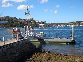
The suburb can be accessed by Port Hacking Road or Saunders Bay Road, both of which lead to Lilli Pilli Point and Wally's Wharf.
Transdev NSW operates bus route 978 to Caringbah and Miranda.