
Pop. density 1 /km (3 /sq mi) Area 12.5 km² | Population 18 (2011) Elevation 293 m Max length 7 km Regional unit Islands | |
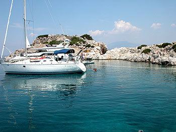 | ||
Dokos (Greek: Δοκός) is a small Greek island of the Argo-Saronic Gulf, adjacent to Hydra, and separated from the Peloponnese by a narrow strait called on some maps "the Hydra Gulf." It is part of the municipality of Ýdra (Hydra) in Islands regional unit and reported a population of 18 persons at the 2011 census. The island is populated only by some Orthodox monks and perennial sheep herders. The island is rocky reaching a height of 308 metres.
Contents
Map of Dokos, Idra 180 40, Greece
ArchaeologyEdit
It has since the ancient years considered to be a strategic location. On the east side lie the ruins of a great Byzantine - Venetian Castle. During the Middle Ages the island served as a refuge for Albanian settlers' animals.
Dokos, according to archaeological studies, has been inhabited since the era of copper, 6000 BC. In 1975 Peter Throckmorton discovered a wreck near Dokos that has been dated to about 2150 BC, and may be the oldest shipwreck known.